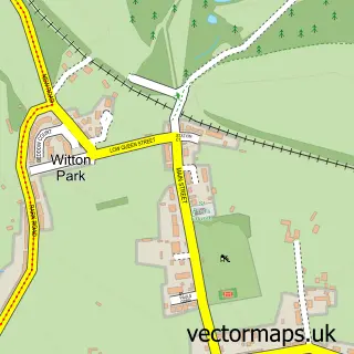
This Hamsterley street map is a detailed vector street map covering a 750m x 750m area. Select a larger area to create and download your own vector street map of Hamsterley.
The 750-metre map sample for Hamsterley covers 118 mapped buildings and approximately 3.9 km of road detail, of which 2 named roads are named. The immediate area includes 1 school and 1 pub. The wider area around Hamsterley features 2 tourism points of interest, 1 food and drink venue and 1 hotel. To create a larger or custom map of Hamsterley, the map builder lets you define your own coverage area and download editable SVG, PDF and PNG files.
Create a larger editable map of Hamsterley
Choose any area you need and generate a high-quality vector map instantly. Perfect for print, planning, design, business and personal use.

This Hamsterley street map in Durham is available as downloadable SVG, PDF and PNG map files, or as a printed map for planning, business, display, education, local information and design work. You can also create a larger custom map area using the map selector.
What this Hamsterley map sample shows
Hamsterley lies within Hamsterley Cp parish, part of Evenwood ward in the County Durham local authority area. The postcode geography for this area includes the DL postcode area, the DL13 postcode district and the DL13 3 postcode sector. Residents fall under the Nhs North East And North Cumbria Integrated Care Board for NHS services.
Local features near Hamsterley
Within 2 milesAmenities and services in and around Hamsterley.
Administrative and postcode information for Hamsterley
Hamsterley lies within Hamsterley Cp parish, part of Evenwood ward in the County Durham local authority area. The postcode geography for this area includes the DL postcode area, the DL13 postcode district and the DL13 3 postcode sector. Residents fall under the Nhs North East And North Cumbria Integrated Care Board for NHS services.
Nearby street map samples around Hamsterley

More street maps in Durham
750 metre map area coverage
Boundary, postcode and point of interest information for the 750m x 750m rectangle centred on this sample map.
Boundaries containing map centre
Constituency: Bishop Auckland Co Const
District: County Durham
Icb: NHS North East and North Cumbria ICB
Parish: Hamsterley CP
Police Force: durham
Postcode District: DL13
Postcode Sector: DL13 3
Nearby boundaries intersecting sample
Parish: South Bedburn CP
Postcode coverage
POI category counts
Farm: 2
Attractions And Activities: 1
Bed And Breakfast: 1
Building Supply Store: 1
Campground: 1
Community Center: 1
Cottage: 1
Elementary School: 1
Hotel: 1
Massage Therapy: 1
Sample points of interest
- Hamsterley Forest
- Cotswold Holiday Cottage, Hamsterley
- Lawn Hero
- Greenacres Caravan Park
- Hamsterley Village Hall
- Roslyn Cottage
- Hamsterley Primary School
- New Field Farm
- Williamson’s Quacking Eggs
- Edge Knoll Holiday Cottages
- County Durham Sports Massage
- County Durham Injury Clinic
Create a larger editable map of Hamsterley
This sample shows only a 750 metre area. To create a larger map of Hamsterley, use our map builder to choose your own coverage area, add titles and download editable SVG, PDF and PNG files.
Create a custom map of Hamsterley