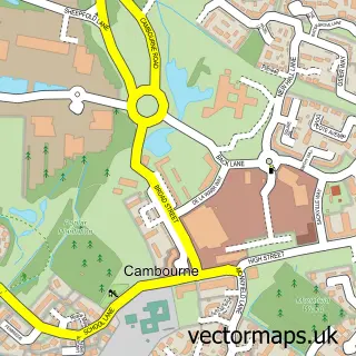
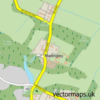
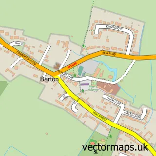
This Hardwick street map is a detailed vector street map covering a 750m x 750m area. Select a larger area to create and download your own vector street map of Hardwick.
The 750-metre map sample for Hardwick covers 173 mapped buildings and approximately 5.4 km of road detail, of which 14 named roads are named. The immediate area includes 1 GP surgery within 2 miles, 1 pub and 1 MOT station within 2 miles. The wider area around Hardwick features 2 food and drink venues. To create a larger or custom map of Hardwick, the map builder lets you define your own coverage area and download editable SVG, PDF and PNG files.
Create a larger editable map of Hardwick
Choose any area you need and generate a high-quality vector map instantly. Perfect for print, planning, design, business and personal use.

This Hardwick street map in Cambridgeshire is available as downloadable SVG, PDF and PNG map files, or as a printed map for planning, business, display, education, local information and design work. You can also create a larger custom map area using the map selector.
What this Hardwick map sample shows
Hardwick lies within Hardwick Cp parish, part of Hardwick ward in the South Cambridgeshire District local authority area. The postcode geography for this area includes the CB postcode area, the CB23 postcode district and the CB23 7 postcode sector. Residents fall under the Nhs Cambridgeshire And Peterborough Integrated Care Board for NHS services.
Local features near Hardwick
Within 2 milesAmenities and services in and around Hardwick.
Administrative and postcode information for Hardwick
Hardwick lies within Hardwick Cp parish, part of Hardwick ward in the South Cambridgeshire District local authority area. The postcode geography for this area includes the CB postcode area, the CB23 postcode district and the CB23 7 postcode sector. Residents fall under the Nhs Cambridgeshire And Peterborough Integrated Care Board for NHS services.
Nearby street map samples around Hardwick

More street maps in Cambridgeshire
750 metre map area coverage
Boundary, postcode and point of interest information for the 750m x 750m rectangle centred on this sample map.
Boundaries containing map centre
Constituency: South Cambridgeshire Co Const
County: Cambridgeshire County
District: South Cambridgeshire District
Icb: NHS Central East ICB
Parish: Hardwick CP
Police Force: cambridgeshire
Postcode District: CB23
Postcode Sector: CB23 7
Ward: Hardwick Ward
Nearby boundaries intersecting sample
No additional intersecting boundaries found.
Postcode coverage
POI category counts
Anglican Church: 2
Auto Detailing: 1
Barber: 1
Bed And Breakfast: 1
Cabin: 1
Department Store: 1
Elementary School: 1
Employment Agencies: 1
Gastropub: 1
Italian Restaurant: 1
Sample points of interest
- St Mary's Church
- St Mary's Church, Hardwick
- Zethna Autos
- Outback barbers
- Wallis Farm House
- Cam Cottage
- Green Energy Options
- Care Fairies
- Polkadotfrog
- The Blue Lion
- The Blue Lion
- The Form Practice
Create a larger editable map of Hardwick
This sample shows only a 750 metre area. To create a larger map of Hardwick, use our map builder to choose your own coverage area, add titles and download editable SVG, PDF and PNG files.
Create a custom map of Hardwick