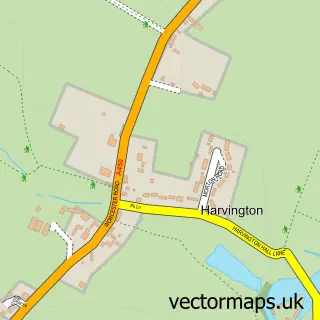
This Hartlebury street map is a detailed vector street map covering a 750m x 750m area. Select a larger area to create and download your own vector street map of Hartlebury.
The 750-metre map sample for Hartlebury covers 189 mapped buildings and approximately 25.6 km of road detail, of which 13 named roads are named. The immediate area includes 2 schools, 1 pub and 9 MOT stations within 2 miles. The wider area around Hartlebury features 1 food and drink venue. To create a larger or custom map of Hartlebury, the map builder lets you define your own coverage area and download editable SVG, PDF and PNG files.
Create a larger editable map of Hartlebury
Choose any area you need and generate a high-quality vector map instantly. Perfect for print, planning, design, business and personal use.

This Hartlebury street map in Worcestershire is available as downloadable SVG, PDF and PNG map files, or as a printed map for planning, business, display, education, local information and design work. You can also create a larger custom map area using the map selector.
What this Hartlebury map sample shows
Hartlebury lies within Hartlebury Cp parish, part of Hartlebury ward in the Wychavon District local authority area. The postcode geography for this area includes the DY postcode area, the DY11 postcode district and the DY11 7 postcode sector. Residents fall under the Nhs Herefordshire And Worcestershire Integrated Care Board for NHS services.
Local features near Hartlebury
Within 2 milesAmenities and services in and around Hartlebury.
Administrative and postcode information for Hartlebury
Hartlebury lies within Hartlebury Cp parish, part of Hartlebury ward in the Wychavon District local authority area. The postcode geography for this area includes the DY postcode area, the DY11 postcode district and the DY11 7 postcode sector. Residents fall under the Nhs Herefordshire And Worcestershire Integrated Care Board for NHS services.
Nearby street map samples around Hartlebury


More street maps in Worcestershire
750 metre map area coverage
Boundary, postcode and point of interest information for the 750m x 750m rectangle centred on this sample map.
Boundaries containing map centre
Constituency: Droitwich and Evesham Co Const
County: Worcestershire County
District: Wychavon District
Icb: NHS Herefordshire and Worcestershire ICB
Parish: Hartlebury CP
Police Force: west mercia
Postcode District: DY11
Postcode Sector: DY11 7
Ward: Hartlebury Ward
Nearby boundaries intersecting sample
No additional intersecting boundaries found.
Postcode coverage
POI category counts
Advertising Agency: 1
Anglican Church: 1
Beauty And Spa: 1
Beer Bar: 1
Business Consulting: 1
Carpet Store: 1
Church Cathedral: 1
Education: 1
Elementary School: 1
Gutter Service: 1
Sample points of interest
- Graphic 1
- Hartlebury: St James
- Natural Elements Skin Care
- The Summerhouse Boningale events page
- Inn House Associates
- Carpets From Home
- St James Church
- New Elizabethan School
- Hartlebury Church of England VC Primary School
- Renew Outdoor Window and Gutter Cleaning
- Skeys Farm
- The White Hart
Create a larger editable map of Hartlebury
This sample shows only a 750 metre area. To create a larger map of Hartlebury, use our map builder to choose your own coverage area, add titles and download editable SVG, PDF and PNG files.
Create a custom map of Hartlebury