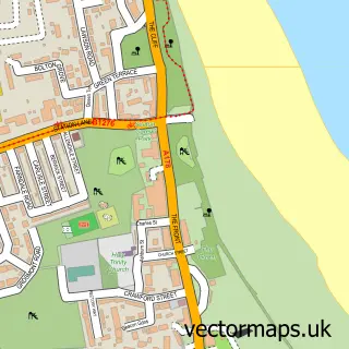
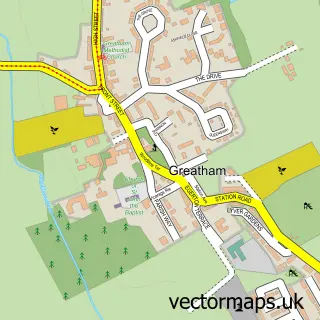
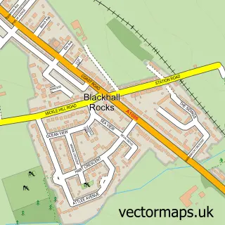
This Hartlepool street map is a detailed vector street map covering a 750m x 750m area. Select a larger area to create and download your own vector street map of Hartlepool.
The 750-metre map sample for Hartlepool covers 149 mapped buildings and approximately 22.9 km of road detail, of which 49 named roads are named. The immediate area includes 2 schools, 1 railway station, 10 GP surgeries within 2 miles and 16 pubs among other local services. The wider area around Hartlepool features 5 tourism points of interest, 38 food and drink venues and 5 hotels. To create a larger or custom map of Hartlepool, the map builder lets you define your own coverage area and download editable SVG, PDF and PNG files.
Create a larger editable map of Hartlepool
Choose any area you need and generate a high-quality vector map instantly. Perfect for print, planning, design, business and personal use.

This Hartlepool street map in Durham is available as downloadable SVG, PDF and PNG map files, or as a printed map for planning, business, display, education, local information and design work. You can also create a larger custom map area using the map selector.
What this Hartlepool map sample shows
Hartlepool lies within Hartlepool (B) parish, part of Victoria ward in the Hartlepool (B) local authority area. The postcode geography for this area includes the TS postcode area, the TS24 postcode district and the TS24 7 postcode sector. Residents fall under the Nhs North East And North Cumbria Integrated Care Board for NHS services.
Local features near Hartlepool
Within 2 milesAmenities and services in and around Hartlepool.
Administrative and postcode information for Hartlepool
The local authority covering Hartlepool is Hartlepool (B), within the county of Durham. The settlement lies within Victoria ward and Hartlepool (B) civil parish. The TS24 postcode district and TS24 7 postcode sector serve the immediate area. NHS provision in the area is delivered through North Tees And Hartlepool Nhs Foundation Trust.
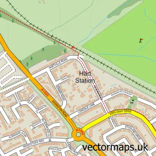
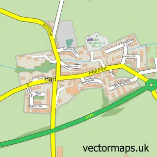
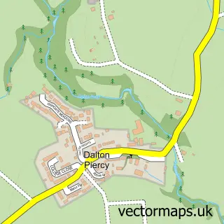
Nearby street map samples around Hartlepool

More street maps in Durham
750 metre map area coverage
Boundary, postcode and point of interest information for the 750m x 750m rectangle centred on this sample map.
Boundaries containing map centre
Constituency: Hartlepool Co Const
District: Hartlepool (B)
Icb: NHS North East and North Cumbria ICB
Police Force: cleveland
Postcode District: TS24
Postcode Sector: TS24 7
Ward: Burn Valley Ward
Nearby boundaries intersecting sample
Postcode District: TS26
Postcode Sector: TS24 0, TS24 8, TS26 9
Ward: Headland & Harbour Ward, Victoria Ward
Postcode coverage
POI category counts
Bar: 20
Beauty Salon: 16
Pub: 16
Clothing Store: 15
Gym: 11
Jewelry Store: 11
Mobile Phone Store: 11
Discount Store: 10
Fast Food Restaurant: 10
Professional Services: 8
Sample points of interest
- Start Hartlepool
- Ama Business Services Ltd.
- Edward Egglestone & Company
- Fortune William and Sons
- King Hope & Co
- Everwell Chinese Medical Centre
- Blast Digital
- Bright Ideas Group
- Hartlepool Wellbeing Centre
- Quicksilver
- Ral
- Royal Gaming
Create a larger editable map of Hartlepool
This sample shows only a 750 metre area. To create a larger map of Hartlepool, use our map builder to choose your own coverage area, add titles and download editable SVG, PDF and PNG files.
Create a custom map of Hartlepool