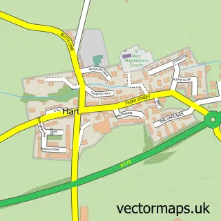
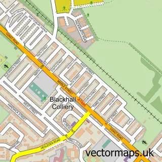
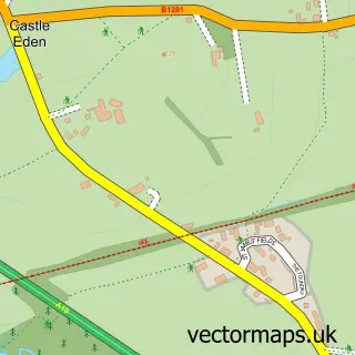
This Hart Station street map is a detailed vector street map covering a 750m x 750m area. Select a larger area to create and download your own vector street map of Hart Station.
The 750-metre map sample for Hart Station covers 340 mapped buildings and approximately 15.0 km of road detail, of which 34 named roads are named. The immediate area includes 2 GP surgeries within 2 miles and 1 MOT station within 2 miles. The wider area around Hart Station features 2 tourism points of interest. To create a larger or custom map of Hart Station, the map builder lets you define your own coverage area and download editable SVG, PDF and PNG files.
Create a larger editable map of Hart Station
Choose any area you need and generate a high-quality vector map instantly. Perfect for print, planning, design, business and personal use.

This Hart Station street map in Durham is available as downloadable SVG, PDF and PNG map files, or as a printed map for planning, business, display, education, local information and design work. You can also create a larger custom map area using the map selector.
What this Hart Station map sample shows
Hart Station lies within Hart Cp parish, part of Hart ward in the Hartlepool (B) local authority area. The postcode geography for this area includes the TS postcode area, the TS27 postcode district and the TS27 3 postcode sector. Residents fall under the Nhs North East And North Cumbria Integrated Care Board for NHS services.
Local features near Hart Station
Within 2 milesAmenities and services in and around Hart Station.
Administrative and postcode information for Hart Station
The local authority covering Hart Station is Hartlepool (B), within the county of Durham. The settlement lies within Hart ward and Hart Cp civil parish. The TS27 postcode district and TS27 3 postcode sector serve the immediate area. NHS provision in the area is delivered through North Tees And Hartlepool Nhs Foundation Trust.
Nearby street map samples around Hart Station
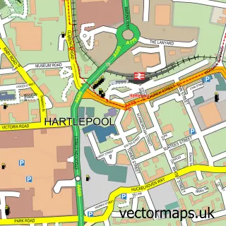

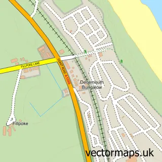
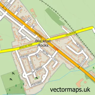
More street maps in Durham
750 metre map area coverage
Boundary, postcode and point of interest information for the 750m x 750m rectangle centred on this sample map.
Boundaries containing map centre
Constituency: Hartlepool Co Const
District: Hartlepool (B)
Icb: NHS North East and North Cumbria ICB
Police Force: cleveland
Postcode District: TS24
Postcode Sector: TS24 9
Ward: De Bruce Ward
Nearby boundaries intersecting sample
Constituency: Easington Co Const
District: County Durham
Parish: Hart CP, Monk Hesleden CP
Police Force: durham
Postcode District: TS27
Postcode Sector: TS27 3
Ward: Hart Ward
Postcode coverage
POI category counts
Accommodation: 1
Beach Equipment Rentals: 1
Building Supply Store: 1
Campground: 1
Castle: 1
Driving School: 1
Hair Salon: 1
Hiking Trail: 1
Lodge: 1
Pet Boarding: 1
Sample points of interest
- Crimdon House Farm
- Arden Hire
- Keep Clean Services
- Hill Enterprises
- Castle Coast Campers
- Hart Station School Of Motoring
- Becca Wilson Aesthetics
- Hart to Haswell Walkway
- Orchard Lodge
- Hill Enterprises
Create a larger editable map of Hart Station
This sample shows only a 750 metre area. To create a larger map of Hart Station, use our map builder to choose your own coverage area, add titles and download editable SVG, PDF and PNG files.
Create a custom map of Hart Station