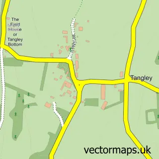
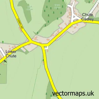
This Hatherden street map is a detailed vector street map covering a 750m x 750m area. Select a larger area to create and download your own vector street map of Hatherden.
The 750-metre map sample for Hatherden covers 77 mapped buildings and approximately 11.1 km of road detail, of which 5 named roads are named. The immediate area includes 1 pub and 1 MOT station within 2 miles. The wider area around Hatherden features 1 tourism point of interest and 1 food and drink venue. To create a larger or custom map of Hatherden, the map builder lets you define your own coverage area and download editable SVG, PDF and PNG files.
Create a larger editable map of Hatherden
Choose any area you need and generate a high-quality vector map instantly. Perfect for print, planning, design, business and personal use.

This Hatherden street map in Hampshire is available as downloadable SVG, PDF and PNG map files, or as a printed map for planning, business, display, education, local information and design work. You can also create a larger custom map area using the map selector.
What this Hatherden map sample shows
Hatherden lies within Tangley Cp parish, part of Bourne Valley ward in the Test Valley District local authority area. The postcode geography for this area includes the SP postcode area, the SP11 postcode district and the SP11 0 postcode sector. Residents fall under the Nhs Hampshire And Isle Of Wight Integrated Care Board for NHS services.
Local features near Hatherden
Within 2 milesAmenities and services in and around Hatherden.
Administrative and postcode information for Hatherden
The local authority covering Hatherden is Test Valley District, within the county of Hampshire. The settlement lies within Bourne Valley ward and Tangley Cp civil parish. The SP11 postcode district and SP11 0 postcode sector serve the immediate area. NHS provision in the area is delivered through Hampshire Hospitals Nhs Foundation Trust.
Nearby street map samples around Hatherden

More street maps in Hampshire
750 metre map area coverage
Boundary, postcode and point of interest information for the 750m x 750m rectangle centred on this sample map.
Boundaries containing map centre
Constituency: North West Hampshire Co Const
County: Hampshire County
District: Test Valley District
Icb: NHS Hampshire and Isle of Wight ICB
Parish: Tangley CP
Police Force: hampshire
Postcode District: SP11
Postcode Sector: SP11 0
Ward: Bourne Valley Ward
Nearby boundaries intersecting sample
No additional intersecting boundaries found.
Postcode coverage
POI category counts
Anglican Church: 1
Bar: 1
Counseling And Mental Health: 1
Gift Shop: 1
Landmark And Historical Building: 1
Mobile Phone Store: 1
Professional Services: 1
Pub: 1
Sample points of interest
- Christ Church Hatherden
- Old Bell And Crown
- The Three Bees Project
- Handmade by Shazzie's
- Hatherden
- Atom Communications
- Rob Harman
- The Old Bell and Crown Hatherden
Create a larger editable map of Hatherden
This sample shows only a 750 metre area. To create a larger map of Hatherden, use our map builder to choose your own coverage area, add titles and download editable SVG, PDF and PNG files.
Create a custom map of Hatherden