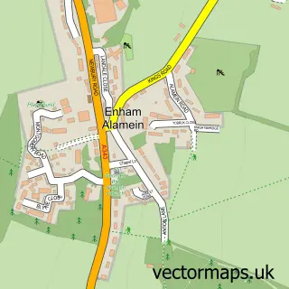
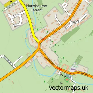
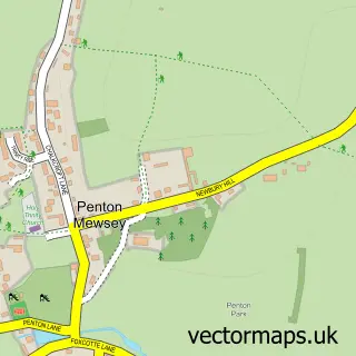
This Upper Enham street map is a detailed vector street map covering a 750m x 750m area. Select a larger area to create and download your own vector street map of Upper Enham.
The 750-metre map sample for Upper Enham covers 73 mapped buildings and approximately 9.1 km of road detail, of which 8 named roads are named. The immediate area includes 1 GP surgery within 2 miles and 1 MOT station within 2 miles. The wider area around Upper Enham features 1 tourism point of interest. To create a larger or custom map of Upper Enham, the map builder lets you define your own coverage area and download editable SVG, PDF and PNG files.
Create a larger editable map of Upper Enham
Choose any area you need and generate a high-quality vector map instantly. Perfect for print, planning, design, business and personal use.

This Upper Enham street map in Hampshire is available as downloadable SVG, PDF and PNG map files, or as a printed map for planning, business, display, education, local information and design work. You can also create a larger custom map area using the map selector.
What this Upper Enham map sample shows
Upper Enham lies within Enham Alamein Cp parish, part of Bourne Valley ward in the Test Valley District local authority area. The postcode geography for this area includes the SP postcode area, the SP11 postcode district and the SP11 6 postcode sector. Residents fall under the Nhs Hampshire And Isle Of Wight Integrated Care Board for NHS services.
Local features near Upper Enham
Within 2 milesAmenities and services in and around Upper Enham.
Administrative and postcode information for Upper Enham
Upper Enham lies within Enham Alamein Cp parish, part of Bourne Valley ward in the Test Valley District local authority area. The postcode geography for this area includes the SP postcode area, the SP11 postcode district and the SP11 6 postcode sector. Residents fall under the Nhs Hampshire And Isle Of Wight Integrated Care Board for NHS services.
Nearby street map samples around Upper Enham

More street maps in Hampshire
750 metre map area coverage
Boundary, postcode and point of interest information for the 750m x 750m rectangle centred on this sample map.
Boundaries containing map centre
Constituency: North West Hampshire Co Const
County: Hampshire County
District: Test Valley District
Icb: NHS Hampshire and Isle of Wight ICB
Parish: Enham Alamein CP
Police Force: hampshire
Postcode District: SP11
Postcode Sector: SP11 6
Ward: Bourne Valley Ward
Nearby boundaries intersecting sample
Parish: Smannell CP, Tangley CP
Postcode Sector: SP11 0
Postcode coverage
POI category counts
Assisted Living Facility: 3
Attractions And Activities: 1
Auto Electrical Repair: 1
Charity Organization: 1
Medical Center: 1
Packing Supply: 1
Retail: 1
Sample points of interest
- Elizabeth House
- Michael House
- Weston Court
- Smannell Woods
- Atwood Electrical
- Enham Trust
- William House
- Enham Packaging
- J M S
Create a larger editable map of Upper Enham
This sample shows only a 750 metre area. To create a larger map of Upper Enham, use our map builder to choose your own coverage area, add titles and download editable SVG, PDF and PNG files.
Create a custom map of Upper Enham