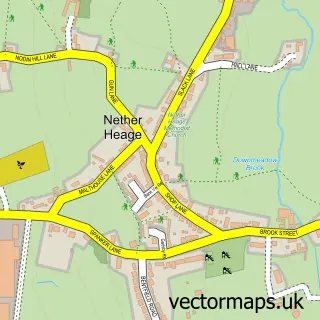
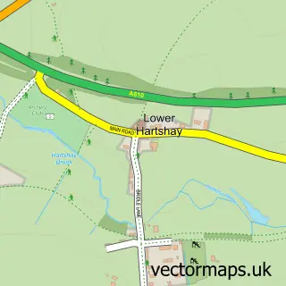
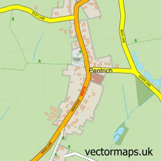
This Heage street map is a detailed vector street map covering a 750m x 750m area. Select a larger area to create and download your own vector street map of Heage.
The 750-metre map sample for Heage covers 335 mapped buildings and approximately 15.7 km of road detail, of which 18 named roads are named. The immediate area includes 1 school, 3 GP surgeries within 2 miles, 3 pubs and 9 MOT stations within 2 miles. The wider area around Heage features 1 tourism point of interest and 3 food and drink venues. To create a larger or custom map of Heage, the map builder lets you define your own coverage area and download editable SVG, PDF and PNG files.
Create a larger editable map of Heage
Choose any area you need and generate a high-quality vector map instantly. Perfect for print, planning, design, business and personal use.

This Heage street map in Derbyshire is available as downloadable SVG, PDF and PNG map files, or as a printed map for planning, business, display, education, local information and design work. You can also create a larger custom map area using the map selector.
What this Heage map sample shows
Heage lies within Ripley Cp parish, part of Heage And Ambergate ward in the Amber Valley District (B) local authority area. The postcode geography for this area includes the DE postcode area, the DE56 postcode district and the DE56 2 postcode sector. Residents fall under the Nhs Derby And Derbyshire Integrated Care Board for NHS services.
Local features near Heage
Within 2 milesAmenities and services in and around Heage.
Administrative and postcode information for Heage
Heage lies within Ripley Cp parish, part of Heage And Ambergate ward in the Amber Valley District (B) local authority area. The postcode geography for this area includes the DE postcode area, the DE56 postcode district and the DE56 2 postcode sector. Residents fall under the Nhs Derby And Derbyshire Integrated Care Board for NHS services.
Nearby street map samples around Heage

More street maps in Derbyshire
750 metre map area coverage
Boundary, postcode and point of interest information for the 750m x 750m rectangle centred on this sample map.
Boundaries containing map centre
Constituency: Amber Valley Co Const
County: Derbyshire County
District: Amber Valley District (B)
Icb: NHS Derby and Derbyshire ICB
Parish: Ripley CP
Police Force: derbyshire
Postcode District: DE56
Postcode Sector: DE56 2
Ward: Heage & Ambergate Ward
Nearby boundaries intersecting sample
No additional intersecting boundaries found.
Postcode coverage
POI category counts
Beauty Salon: 3
Pub: 3
Bakery: 2
Beauty And Spa: 2
Building Supply Store: 2
Church Cathedral: 2
Hair Salon: 2
Home Service: 2
Roofing: 2
Art Gallery: 1
Sample points of interest
- Art By Mandy UK
- Mr R Booth
- Cakes For Special Occasions
- Delicious Designs
- Eagle Tavern
- Finlays Ladies & Gents Hairdressing
- LJ's Beauty
- Melanie Lewendon Nail Artist & Training
- A Touch Of Beauty
- JH Hair
- Nouvelle Belle Clinical Beauticians and Aesthetics
- Amber Tree Management
Create a larger editable map of Heage
This sample shows only a 750 metre area. To create a larger map of Heage, use our map builder to choose your own coverage area, add titles and download editable SVG, PDF and PNG files.
Create a custom map of Heage