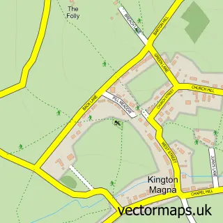
This Henstridge street map is a detailed vector street map covering a 750m x 750m area. Select a larger area to create and download your own vector street map of Henstridge.
The 750-metre map sample for Henstridge covers 382 mapped buildings and approximately 16.2 km of road detail, of which 36 named roads are named. The immediate area includes 1 school, 2 pubs and 3 MOT stations within 2 miles. The wider area around Henstridge features 2 food and drink venues and 1 campsite within 2 miles. To create a larger or custom map of Henstridge, the map builder lets you define your own coverage area and download editable SVG, PDF and PNG files.
Create a larger editable map of Henstridge
Choose any area you need and generate a high-quality vector map instantly. Perfect for print, planning, design, business and personal use.

This Henstridge street map in Somerset is available as downloadable SVG, PDF and PNG map files, or as a printed map for planning, business, display, education, local information and design work. You can also create a larger custom map area using the map selector.
What this Henstridge map sample shows
Henstridge lies within Henstridge Cp parish, part of Blackmoor Vale ward in the Somerset local authority area. The postcode geography for this area includes the BA postcode area, the BA8 postcode district and the BA8 0 postcode sector. Residents fall under the Nhs Somerset Integrated Care Board for NHS services.
Local features near Henstridge
Within 2 milesAmenities and services in and around Henstridge.
Administrative and postcode information for Henstridge
Henstridge lies within Henstridge Cp parish, part of Blackmoor Vale ward in the Somerset local authority area. The postcode geography for this area includes the BA postcode area, the BA8 postcode district and the BA8 0 postcode sector. Residents fall under the Nhs Somerset Integrated Care Board for NHS services.
Nearby street map samples around Henstridge

More street maps in Somerset
750 metre map area coverage
Boundary, postcode and point of interest information for the 750m x 750m rectangle centred on this sample map.
Boundaries containing map centre
Constituency: Glastonbury and Somerton Co Const
District: Somerset
Icb: NHS Somerset ICB
Parish: Henstridge CP
Police Force: avon and somerset
Postcode District: BA8
Postcode Sector: BA8 0
Nearby boundaries intersecting sample
No additional intersecting boundaries found.
Postcode coverage
POI category counts
Elementary School: 2
Funeral Services And Cemeteries: 2
Pub: 2
Anglican Church: 1
Arts And Entertainment: 1
Automotive Repair: 1
Beauty And Spa: 1
Books Mags Music And Video: 1
Bridal Shop: 1
Building Supply Store: 1
Sample points of interest
- St Nicholas, Henstridge
- Little Yet Large
- Precision Clutch Components Ltd
- ZB Nails
- March House Books
- R Young
- D G Carpentry & Joinery
- St Nicholas Church
- Henstridge Village Hall
- Henstridge Village Store
- Explorers Pre-School, Henstridge
- Hounds and Hooves
Create a larger editable map of Henstridge
This sample shows only a 750 metre area. To create a larger map of Henstridge, use our map builder to choose your own coverage area, add titles and download editable SVG, PDF and PNG files.
Create a custom map of Henstridge