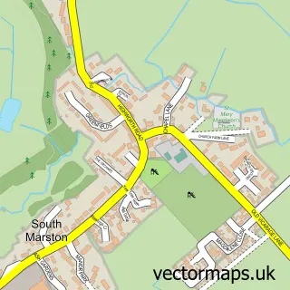
This Highworth street map is a detailed vector street map covering a 750m x 750m area. Select a larger area to create and download your own vector street map of Highworth.
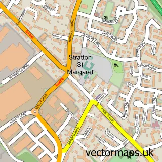
The 750-metre map sample for Highworth covers 451 mapped buildings and approximately 19.5 km of road detail, of which 48 named roads are named. The immediate area includes 2 primary schools and 1 secondary school, 1 GP surgery, 7 pubs and 2 MOT stations within 2 miles. The wider area around Highworth features 1 tourism point of interest, 13 food and drink venues and 2 hotels. To create a larger or custom map of Highworth, the map builder lets you define your own coverage area and download editable SVG, PDF and PNG files.
Create a larger editable map of Highworth
Choose any area you need and generate a high-quality vector map instantly. Perfect for print, planning, design, business and personal use.

This Highworth street map in Wiltshire is available as downloadable SVG, PDF and PNG map files, or as a printed map for planning, business, display, education, local information and design work. You can also create a larger custom map area using the map selector.
What this Highworth map sample shows
Highworth lies within Highworth Cp parish, part of Blunsdon And Highworth ward in the Swindon (B) local authority area. The postcode geography for this area includes the SN postcode area, the SN6 postcode district and the SN6 7 postcode sector. Residents fall under the Nhs Bath And North East Somerset, Swindon And Wiltshire Integrated Care Board for NHS services.
Local features near Highworth
Within 2 milesAmenities and services in and around Highworth.
Administrative and postcode information for Highworth
Highworth lies within Highworth Cp parish, part of Blunsdon And Highworth ward in the Swindon (B) local authority area. The postcode geography for this area includes the SN postcode area, the SN6 postcode district and the SN6 7 postcode sector. Residents fall under the Nhs Bath And North East Somerset, Swindon And Wiltshire Integrated Care Board for NHS services.
Nearby street map samples around Highworth

More street maps in Wiltshire
750 metre map area coverage
Boundary, postcode and point of interest information for the 750m x 750m rectangle centred on this sample map.
Boundaries containing map centre
Constituency: Swindon North Co Const
District: Swindon (B)
Icb: NHS Bath and North East Somerset Swindon and Wiltshire ICB
Parish: Highworth CP
Police Force: wiltshire
Postcode District: SN6
Postcode Sector: SN6 7
Ward: Blunsdon and Highworth Ward
Nearby boundaries intersecting sample
No additional intersecting boundaries found.
Postcode coverage
POI category counts
Church Cathedral: 7
Pub: 7
Convenience Store: 6
Beauty Salon: 5
Funeral Services And Cemeteries: 5
Indian Restaurant: 5
Bakery: 4
Hair Salon: 4
Martial Arts Club: 4
Professional Services: 4
Sample points of interest
- Addictions Rehabilitation Centre
- Citrus Creative
- Obelisk Design
- Stables Studio
- Highworth: St Michael and all Angels
- Home Plan Design Services
- 659Design
- White Horse Folk Club
- MFG Peregrine - Highworth (Simon Smith Group)
- Midcounties Co-Op Brewery Street
- PayPoint
- CHLOE'S
Create a larger editable map of Highworth
This sample shows only a 750 metre area. To create a larger map of Highworth, use our map builder to choose your own coverage area, add titles and download editable SVG, PDF and PNG files.
Create a custom map of Highworth