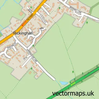
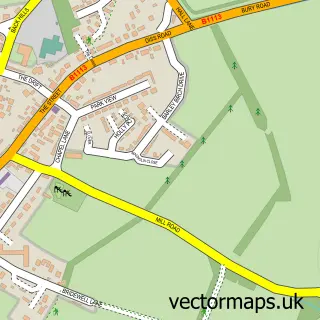
This Hinderclay street map is a detailed vector street map covering a 750m x 750m area. Select a larger area to create and download your own vector street map of Hinderclay.
The 750-metre map sample for Hinderclay covers 121 mapped buildings and approximately 6.7 km of road detail, of which 6 named roads are named. The immediate area includes 1 GP surgery within 2 miles and 1 MOT station within 2 miles. To create a larger or custom map of Hinderclay, the map builder lets you define your own coverage area and download editable SVG, PDF and PNG files.
Create a larger editable map of Hinderclay
Choose any area you need and generate a high-quality vector map instantly. Perfect for print, planning, design, business and personal use.

This Hinderclay street map in Suffolk is available as downloadable SVG, PDF and PNG map files, or as a printed map for planning, business, display, education, local information and design work. You can also create a larger custom map area using the map selector.
What this Hinderclay map sample shows
Hinderclay lies within Hinderclay Cp parish, part of Rickinghall ward in the Mid Suffolk District local authority area. The postcode geography for this area includes the IP postcode area, the IP22 postcode district and the IP22 1 postcode sector. Residents fall under the Nhs Suffolk And North East Essex Integrated Care Board for NHS services.
Local features near Hinderclay
Within 2 milesAmenities and services in and around Hinderclay.
Administrative and postcode information for Hinderclay
Hinderclay lies within Hinderclay Cp parish, part of Rickinghall ward in the Mid Suffolk District local authority area. The postcode geography for this area includes the IP postcode area, the IP22 postcode district and the IP22 1 postcode sector. Residents fall under the Nhs Suffolk And North East Essex Integrated Care Board for NHS services.
Nearby street map samples around Hinderclay


More street maps in Suffolk
750 metre map area coverage
Boundary, postcode and point of interest information for the 750m x 750m rectangle centred on this sample map.
Boundaries containing map centre
Constituency: Waveney Valley Co Const
County: Suffolk County
District: Mid Suffolk District
Icb: NHS Essex ICB
Parish: Hinderclay CP
Police Force: suffolk
Postcode District: IP22
Postcode Sector: IP22 1
Ward: Rickinghall Ward
Nearby boundaries intersecting sample
No additional intersecting boundaries found.
Postcode coverage
POI category counts
Anglican Church: 1
Counseling And Mental Health: 1
Furniture Manufacturers: 1
Home Goods Store: 1
Land Surveying: 1
Nursery And Gardening: 1
Storage Facility: 1
Sample points of interest
- Hinderclay, St Mary
- Aisling Counselling
- Essential Interiors
- Russet Interiors
- D K Surveys
- Practical Plants Ltd
- Er Moves
Create a larger editable map of Hinderclay
This sample shows only a 750 metre area. To create a larger map of Hinderclay, use our map builder to choose your own coverage area, add titles and download editable SVG, PDF and PNG files.
Create a custom map of Hinderclay