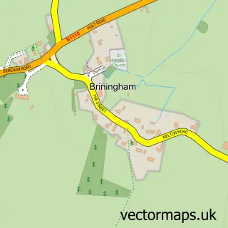
This Hindolveston street map is a detailed vector street map covering a 750m x 750m area. Select a larger area to create and download your own vector street map of Hindolveston.
The 750-metre map sample for Hindolveston covers 169 mapped buildings and approximately 6.5 km of road detail, of which 4 named roads are named. To create a larger or custom map of Hindolveston, the map builder lets you define your own coverage area and download editable SVG, PDF and PNG files.
Create a larger editable map of Hindolveston
Choose any area you need and generate a high-quality vector map instantly. Perfect for print, planning, design, business and personal use.

This Hindolveston street map in Norfolk is available as downloadable SVG, PDF and PNG map files, or as a printed map for planning, business, display, education, local information and design work. You can also create a larger custom map area using the map selector.
What this Hindolveston map sample shows
Hindolveston lies within Hindolveston Cp parish, part of Stibbard ward in the North Norfolk District local authority area. The postcode geography for this area includes the NR postcode area, the NR20 postcode district and the NR20 5 postcode sector. Residents fall under the Nhs Norfolk And Waveney Integrated Care Board for NHS services.
Administrative and postcode information for Hindolveston
Hindolveston lies within Hindolveston Cp parish, part of Stibbard ward in the North Norfolk District local authority area. The postcode geography for this area includes the NR postcode area, the NR20 postcode district and the NR20 5 postcode sector. Residents fall under the Nhs Norfolk And Waveney Integrated Care Board for NHS services.
Nearby street map samples around Hindolveston

More street maps in Norfolk
750 metre map area coverage
Boundary, postcode and point of interest information for the 750m x 750m rectangle centred on this sample map.
Boundaries containing map centre
Constituency: Broadland and Fakenham Co Const
County: Norfolk County
District: North Norfolk District
Icb: NHS Norfolk and Waveney ICB
Parish: Hindolveston CP
Police Force: norfolk
Postcode District: NR20
Postcode Sector: NR20 5
Ward: Stibbard Ward
Nearby boundaries intersecting sample
No additional intersecting boundaries found.
Postcode coverage
POI category counts
Arts And Crafts: 2
Childrens Clothing Store: 2
Accommodation: 1
Bed And Breakfast: 1
Building Supply Store: 1
Clothing Store: 1
Gardener: 1
Health And Medical: 1
Pest Control Service: 1
Pet Groomer: 1
Sample points of interest
- Cooper's House
- The Traditional Rope Company
- The Traditional Rope Company
- White House Farm
- Vardigans Electrical
- Oldfield Clothing
- Oldfield Outfitters
- Oldfield Clothing
- Garden Services
- Telecare Choice
- Banish Pest Control
- The Dog Shed
Create a larger editable map of Hindolveston
This sample shows only a 750 metre area. To create a larger map of Hindolveston, use our map builder to choose your own coverage area, add titles and download editable SVG, PDF and PNG files.
Create a custom map of Hindolveston