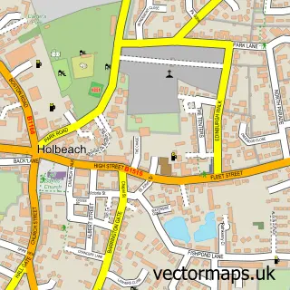
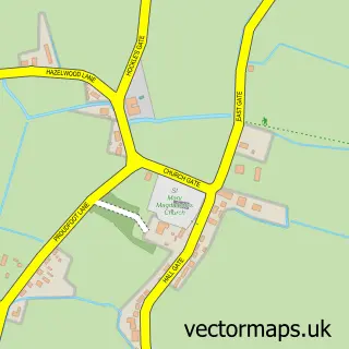
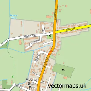
This Holbeach Hurn street map is a detailed vector street map covering a 750m x 750m area. Select a larger area to create and download your own vector street map of Holbeach Hurn.
The 750-metre map sample for Holbeach Hurn covers 90 mapped buildings and approximately 10.1 km of road detail, of which 6 named roads are named. The immediate area includes 4 MOT stations within 2 miles. The wider area around Holbeach Hurn features 1 tourism point of interest and 2 campsites within 2 miles. To create a larger or custom map of Holbeach Hurn, the map builder lets you define your own coverage area and download editable SVG, PDF and PNG files.
Create a larger editable map of Holbeach Hurn
Choose any area you need and generate a high-quality vector map instantly. Perfect for print, planning, design, business and personal use.

This Holbeach Hurn street map in Lincolnshire is available as downloadable SVG, PDF and PNG map files, or as a printed map for planning, business, display, education, local information and design work. You can also create a larger custom map area using the map selector.
What this Holbeach Hurn map sample shows
Holbeach Hurn lies within Holbeach Cp parish, part of Holbeach Hurn ward in the South Holland District local authority area. The postcode geography for this area includes the PE postcode area, the PE12 postcode district and the PE12 8 postcode sector. Residents fall under the Nhs Lincolnshire Integrated Care Board for NHS services.
Local features near Holbeach Hurn
Within 2 milesAmenities and services in and around Holbeach Hurn.
Administrative and postcode information for Holbeach Hurn
The local authority covering Holbeach Hurn is South Holland District, within the county of Lincolnshire. The settlement lies within Holbeach Hurn ward and Holbeach Cp civil parish. The PE12 postcode district and PE12 8 postcode sector serve the immediate area. NHS provision in the area is delivered through The Queen Elizabeth Hospital, King's Lynn, Nhs Foundation Trust.
Nearby street map samples around Holbeach Hurn

More street maps in Lincolnshire
750 metre map area coverage
Boundary, postcode and point of interest information for the 750m x 750m rectangle centred on this sample map.
Boundaries containing map centre
Constituency: South Holland and The Deepings Co Const
County: Lincolnshire County
District: South Holland District
Icb: NHS Lincolnshire ICB
Parish: Holbeach CP
Police Force: lincolnshire
Postcode District: PE12
Postcode Sector: PE12 8
Ward: Holbeach Hurn Ward
Nearby boundaries intersecting sample
No additional intersecting boundaries found.
Postcode coverage
POI category counts
Building Supply Store: 2
Alternative Medicine: 1
Anglican Church: 1
Campground: 1
Chinese Restaurant: 1
Community Center: 1
Fabric Wholesaler: 1
Gardener: 1
Land Surveying: 1
Pet Services: 1
Sample points of interest
- Holistic Therapies
- St Luke, Holbeach Hurn
- CTM Property Maintenance & Home Improvements
- V W Camper Curtains
- Rose and Crown
- The Garden House
- Holbeach Hurn Village Hall
- V W Camper Curtains
- D W Woods Landscaping
- Lincs Home Condition Reports
- Tilly-blues grooming parlour
- Lincs Home Condition Reports
Create a larger editable map of Holbeach Hurn
This sample shows only a 750 metre area. To create a larger map of Holbeach Hurn, use our map builder to choose your own coverage area, add titles and download editable SVG, PDF and PNG files.
Create a custom map of Holbeach Hurn