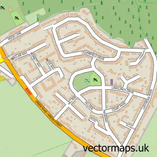
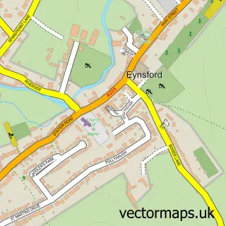
This Horton Kirby street map is a detailed vector street map covering a 750m x 750m area. Select a larger area to create and download your own vector street map of Horton Kirby.
The 750-metre map sample for Horton Kirby covers 232 mapped buildings and approximately 13.7 km of road detail, of which 14 named roads are named. The immediate area includes 1 school, 1 GP surgery within 2 miles, 3 pubs and 1 MOT station, with 3 within 2 miles. The wider area around Horton Kirby features 1 tourism point of interest and 3 food and drink venues. To create a larger or custom map of Horton Kirby, the map builder lets you define your own coverage area and download editable SVG, PDF and PNG files.
Create a larger editable map of Horton Kirby
Choose any area you need and generate a high-quality vector map instantly. Perfect for print, planning, design, business and personal use.

This Horton Kirby street map in Kent is available as downloadable SVG, PDF and PNG map files, or as a printed map for planning, business, display, education, local information and design work. You can also create a larger custom map area using the map selector.
What this Horton Kirby map sample shows
Horton Kirby lies within Horton Kirby And South Darenth Cp parish, part of Farningham, Horton Kirby And South Darenth ward in the Sevenoaks District local authority area. The postcode geography for this area includes the DA postcode area, the DA4 postcode district and the DA4 9 postcode sector. Residents fall under the Nhs Kent And Medway Integrated Care Board for NHS services.
Local features near Horton Kirby
Within 2 milesAmenities and services in and around Horton Kirby.
Administrative and postcode information for Horton Kirby
Horton Kirby lies within Horton Kirby And South Darenth Cp parish, part of Farningham, Horton Kirby And South Darenth ward in the Sevenoaks District local authority area. The postcode geography for this area includes the DA postcode area, the DA4 postcode district and the DA4 9 postcode sector. Residents fall under the Nhs Kent And Medway Integrated Care Board for NHS services.
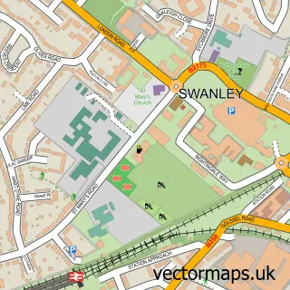
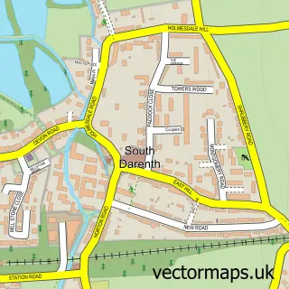
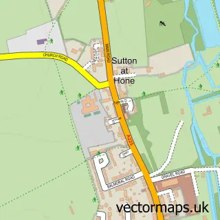
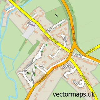
Nearby street map samples around Horton Kirby

More street maps in Kent
750 metre map area coverage
Boundary, postcode and point of interest information for the 750m x 750m rectangle centred on this sample map.
Boundaries containing map centre
Constituency: Sevenoaks Co Const
County: Kent County
District: Sevenoaks District
Icb: NHS Kent and Medway ICB
Parish: Horton Kirby and South Darenth CP
Police Force: kent
Postcode District: DA4
Postcode Sector: DA4 9
Ward: Farningham, Horton Kirby and South Darenth Ward
Nearby boundaries intersecting sample
No additional intersecting boundaries found.
Postcode coverage
POI category counts
Automotive Repair: 3
Pub: 3
Education: 2
Accountant: 1
Anglican Church: 1
Automotive Parts And Accessories: 1
Beauty Salon: 1
Building Supply Store: 1
Business Consulting: 1
Caterer: 1
Sample points of interest
- Fraser Accounting
- St Mary's Horton Kirby
- LandRover Connectors
- Balan Autos Garage
- Kvt mot service car diagnostic
- Motor Engineer Specialist
- Serenity Beauty
- Everwood Construction
- SWA Consulting
- Catersave Europe Ltd.
- St Mary's Church
- Cleaners Horton Kirby
Create a larger editable map of Horton Kirby
This sample shows only a 750 metre area. To create a larger map of Horton Kirby, use our map builder to choose your own coverage area, add titles and download editable SVG, PDF and PNG files.
Create a custom map of Horton Kirby