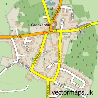
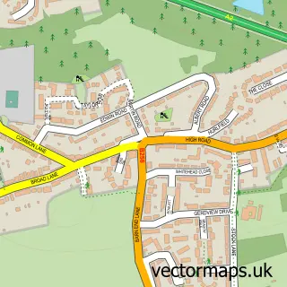
This Swanley street map is a detailed vector street map covering a 750m x 750m area. Select a larger area to create and download your own vector street map of Swanley.
The 750-metre map sample for Swanley covers 315 mapped buildings and approximately 14.0 km of road detail, of which 29 named roads are named. The immediate area includes 2 primary schools and 1 secondary school, 1 railway station, 1 GP surgery and 1 pub among other local services. The wider area around Swanley features 3 tourism points of interest and 6 food and drink venues. To create a larger or custom map of Swanley, the map builder lets you define your own coverage area and download editable SVG, PDF and PNG files.
Create a larger editable map of Swanley
Choose any area you need and generate a high-quality vector map instantly. Perfect for print, planning, design, business and personal use.

This Swanley street map in Kent is available as downloadable SVG, PDF and PNG map files, or as a printed map for planning, business, display, education, local information and design work. You can also create a larger custom map area using the map selector.
What this Swanley map sample shows
Swanley lies within Swanley Cp parish, part of Swanley White Oak ward in the Sevenoaks District local authority area. The postcode geography for this area includes the BR postcode area, the BR8 postcode district and the BR8 7 postcode sector. Residents fall under the Nhs Kent And Medway Integrated Care Board for NHS services.
Local features near Swanley
Within 2 milesAmenities and services in and around Swanley.
Administrative and postcode information for Swanley
The local authority covering Swanley is Sevenoaks District, within the county of Kent. The settlement lies within Swanley White Oak ward and Swanley Cp civil parish. The BR8 postcode district and BR8 7 postcode sector serve the immediate area. NHS provision in the area is delivered through Dartford And Gravesham Nhs Trust.
Nearby street map samples around Swanley


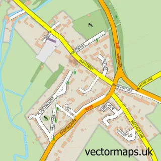
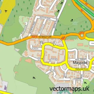
More street maps in Kent
750 metre map area coverage
Boundary, postcode and point of interest information for the 750m x 750m rectangle centred on this sample map.
Boundaries containing map centre
Constituency: Sevenoaks Co Const
County: Kent County
District: Sevenoaks District
Icb: NHS Kent and Medway ICB
Parish: Swanley CP
Police Force: kent
Postcode District: BR8
Postcode Sector: BR8 7
Ward: Swanley St. Mary's Ward
Nearby boundaries intersecting sample
Postcode Sector: BR8 8
Ward: Swanley Christchurch and Swanley Village Ward, Swanley White Oak Ward
Postcode coverage
POI category counts
Professional Services: 7
Supermarket: 6
Dentist: 5
Pharmacy: 5
Betting Center: 4
Elementary School: 4
Fast Food Restaurant: 4
Gym: 4
Post Office: 4
Barber: 3
Sample points of interest
- Sargeant Partnership
- St Mary C Of E Church
- Swanley: St Mary
- Patch And Mix Crafts
- Swanley Banqueting
- PayPoint
- Swanley Recreational Ground Play Area
- G C Motors Centre For Minis
- Copley's Cake House
- Barclays Bank
- NatWest
- COBAN Barber Swanley
Create a larger editable map of Swanley
This sample shows only a 750 metre area. To create a larger map of Swanley, use our map builder to choose your own coverage area, add titles and download editable SVG, PDF and PNG files.
Create a custom map of Swanley