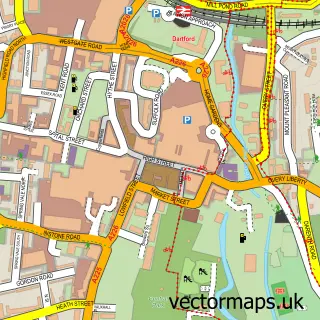
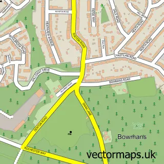
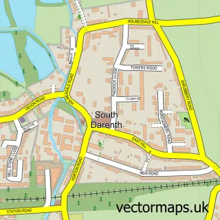
This Wilmington street map is a detailed vector street map covering a 750m x 750m area. Select a larger area to create and download your own vector street map of Wilmington.
The 750-metre map sample for Wilmington covers 335 mapped buildings and approximately 10.5 km of road detail, of which 21 named roads are named. The immediate area includes 1 school, 7 GP surgeries within 2 miles and 26 MOT stations within 2 miles. The wider area around Wilmington features 1 food and drink venue. To create a larger or custom map of Wilmington, the map builder lets you define your own coverage area and download editable SVG, PDF and PNG files.
Create a larger editable map of Wilmington
Choose any area you need and generate a high-quality vector map instantly. Perfect for print, planning, design, business and personal use.

This Wilmington street map in Kent is available as downloadable SVG, PDF and PNG map files, or as a printed map for planning, business, display, education, local information and design work. You can also create a larger custom map area using the map selector.
What this Wilmington map sample shows
Wilmington lies within Wilmington Cp parish, part of Wilmington, Sutton-At-Hone & Hawley ward in the Dartford District (B) local authority area. The postcode geography for this area includes the DA postcode area, the DA2 postcode district and the DA2 7 postcode sector. Residents fall under the Nhs Kent And Medway Integrated Care Board for NHS services.
Local features near Wilmington
Within 2 milesAmenities and services in and around Wilmington.
Administrative and postcode information for Wilmington
The local authority covering Wilmington is Dartford District (B), within the county of Kent. The settlement lies within Wilmington, Sutton-At-Hone & Hawley ward and Wilmington Cp civil parish. The DA2 postcode district and DA2 7 postcode sector serve the immediate area. NHS provision in the area is delivered through Dartford And Gravesham Nhs Trust.
Nearby street map samples around Wilmington

More street maps in Kent
750 metre map area coverage
Boundary, postcode and point of interest information for the 750m x 750m rectangle centred on this sample map.
Boundaries containing map centre
Constituency: Sevenoaks Co Const
County: Kent County
District: Dartford District (B)
Icb: NHS Kent and Medway ICB
Parish: Wilmington CP
Police Force: kent
Postcode District: DA2
Postcode Sector: DA2 7
Ward: Wilmington, Sutton-at-Hone & Hawley Ward
Nearby boundaries intersecting sample
Constituency: Dartford Co Const
Postcode District: DA1
Postcode Sector: DA1 2
Ward: Maypole & Leyton Cross Ward
Postcode coverage
POI category counts
Cleaning Services: 2
Education: 2
Elementary School: 2
Session Photography: 2
Bar: 1
Beauty Salon: 1
Building Supply Store: 1
Community Center: 1
Disability Services And Support Organization: 1
Electrician: 1
Sample points of interest
- The Foresters
- Stevies hair studio
- Mini Digger Hire
- Carpet Cleaning Wilmington
- Cleaners Wilmington
- Wilmington Memorial Hall
- Liaise - Knoll House
- North West Kent Behaviour Service
- Rowhill School
- G 3 Electrical
- Wilmington Primary School
- Wilmington Primary School
Create a larger editable map of Wilmington
This sample shows only a 750 metre area. To create a larger map of Wilmington, use our map builder to choose your own coverage area, add titles and download editable SVG, PDF and PNG files.
Create a custom map of Wilmington