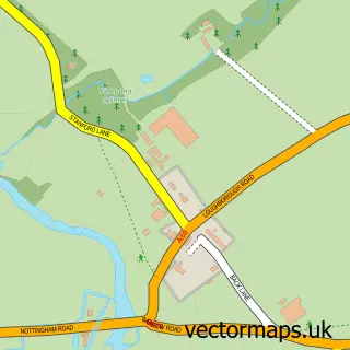
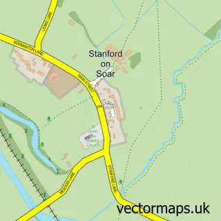
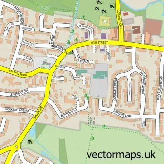
This Hoton street map is a detailed vector street map covering a 750m x 750m area. Select a larger area to create and download your own vector street map of Hoton.
The 750-metre map sample for Hoton covers 126 mapped buildings and approximately 18.6 km of road detail, of which 8 named roads are named. The immediate area includes 1 pub and 2 MOT stations within 2 miles. The wider area around Hoton features 1 tourism point of interest and 1 food and drink venue. To create a larger or custom map of Hoton, the map builder lets you define your own coverage area and download editable SVG, PDF and PNG files.
Create a larger editable map of Hoton
Choose any area you need and generate a high-quality vector map instantly. Perfect for print, planning, design, business and personal use.

This Hoton street map in Leicestershire is available as downloadable SVG, PDF and PNG map files, or as a printed map for planning, business, display, education, local information and design work. You can also create a larger custom map area using the map selector.
What this Hoton map sample shows
Hoton lies within Hoton Cp parish, part of The Wolds ward in the Charnwood District (B) local authority area. The postcode geography for this area includes the LE postcode area, the LE12 postcode district and the LE12 5 postcode sector. Residents fall under the Nhs Leicester, Leicestershire And Rutland Integrated Care Board for NHS services.
Local features near Hoton
Within 2 milesAmenities and services in and around Hoton.
Administrative and postcode information for Hoton
Hoton lies within Hoton Cp parish, part of The Wolds ward in the Charnwood District (B) local authority area. The postcode geography for this area includes the LE postcode area, the LE12 postcode district and the LE12 5 postcode sector. Residents fall under the Nhs Leicester, Leicestershire And Rutland Integrated Care Board for NHS services.
Nearby street map samples around Hoton
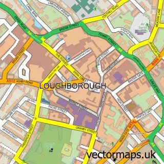

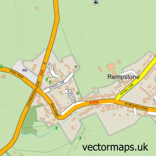
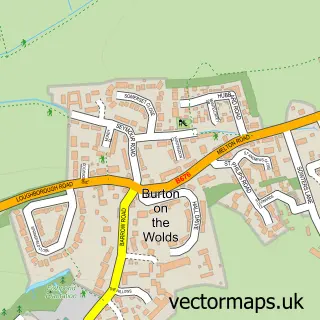
More street maps in Leicestershire
750 metre map area coverage
Boundary, postcode and point of interest information for the 750m x 750m rectangle centred on this sample map.
Boundaries containing map centre
Constituency: Loughborough Co Const
County: Leicestershire County
District: Charnwood District (B)
Icb: NHS Leicester Leicestershire and Rutland ICB
Parish: Hoton CP
Police Force: leicestershire
Postcode District: LE12
Postcode Sector: LE12 5
Ward: The Wolds Ward
Nearby boundaries intersecting sample
No additional intersecting boundaries found.
Postcode coverage
POI category counts
Building Supply Store: 2
Pet Services: 2
Storage Facility: 2
Acupuncture: 1
Amusement Park: 1
Community Services Non Profits: 1
Contractor: 1
Engineering Services: 1
Environmental And Ecological Services For Businesses: 1
Event Technology Service: 1
Sample points of interest
- Cycles of Change Acupuncture
- Funfairhires
- J R C Landscapes & Driveways
- Tradeshake
- Hoton Village Hall
- Cairns Heritage Homes
- NJC Power Ltd
- Castledine Environmental
- Tyler Events
- Smart Shopping
- The Packe Arms
- Iced Gem Celebration And Wedding Cakes
Create a larger editable map of Hoton
This sample shows only a 750 metre area. To create a larger map of Hoton, use our map builder to choose your own coverage area, add titles and download editable SVG, PDF and PNG files.
Create a custom map of Hoton