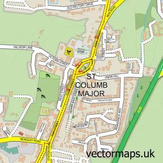
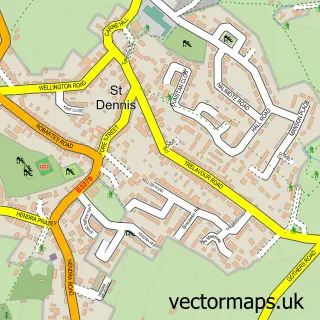
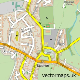
This Indian Queens street map is a detailed vector street map covering a 750m x 750m area. Select a larger area to create and download your own vector street map of Indian Queens.
The 750-metre map sample for Indian Queens covers 420 mapped buildings and approximately 17.5 km of road detail, of which 24 named roads are named. The immediate area includes 1 school and 3 MOT stations within 2 miles. The wider area around Indian Queens features 2 campsites within 2 miles. To create a larger or custom map of Indian Queens, the map builder lets you define your own coverage area and download editable SVG, PDF and PNG files.
Create a larger editable map of Indian Queens
Choose any area you need and generate a high-quality vector map instantly. Perfect for print, planning, design, business and personal use.

This Indian Queens street map in Cornwall is available as downloadable SVG, PDF and PNG map files, or as a printed map for planning, business, display, education, local information and design work. You can also create a larger custom map area using the map selector.
What this Indian Queens map sample shows
Indian Queens lies within St. Enoder Cp parish, part of St Enoder ward in the Cornwall local authority area. The postcode geography for this area includes the TR postcode area, the TR9 postcode district and the TR9 6 postcode sector. Residents fall under the Nhs Cornwall And The Isles Of Scilly Integrated Care Board for NHS services.
Local features near Indian Queens
Within 2 milesAmenities and services in and around Indian Queens.
Administrative and postcode information for Indian Queens
The local authority covering Indian Queens is Cornwall, within the county of Cornwall. The settlement lies within St Enoder ward and St. Enoder Cp civil parish. The TR9 postcode district and TR9 6 postcode sector serve the immediate area. NHS provision in the area is delivered through Royal Cornwall Hospitals Nhs Trust.
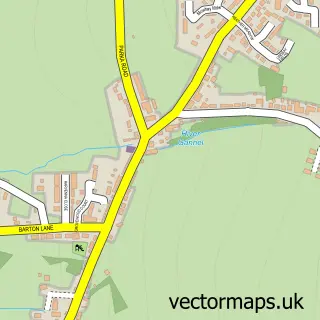
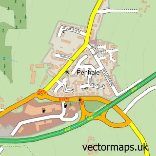
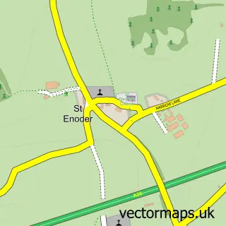
Nearby street map samples around Indian Queens

More street maps in Cornwall
750 metre map area coverage
Boundary, postcode and point of interest information for the 750m x 750m rectangle centred on this sample map.
Boundaries containing map centre
Constituency: St. Austell and Newquay Co Const
District: Cornwall
Icb: NHS Cornwall and the Isles of Scilly ICB
Parish: St. Enoder CP
Police Force: devon and cornwall
Postcode District: TR9
Postcode Sector: TR9 6
Nearby boundaries intersecting sample
No additional intersecting boundaries found.
Postcode coverage
POI category counts
Beauty Salon: 3
Convenience Store: 2
Gas Station: 2
Preschool: 2
Accountant: 1
Anglican Church: 1
Arts And Crafts: 1
Atms: 1
Beauty And Spa: 1
Building Supply Store: 1
Sample points of interest
- Arthur Hamiltons SW Ltd
- Indian Queens (St Francis)
- Fraddon Pottery
- The Cooperative Food (BF) St Columb Road, Fraddon
- Shell's Nails And Beauty
- Elements
- The Beauty Hub
- The Crafting Farmer
- CS Plumbing
- Newquay Jive
- New Garden Chinese Restaurant
- Victory Hall
Create a larger editable map of Indian Queens
This sample shows only a 750 metre area. To create a larger map of Indian Queens, use our map builder to choose your own coverage area, add titles and download editable SVG, PDF and PNG files.
Create a custom map of Indian Queens