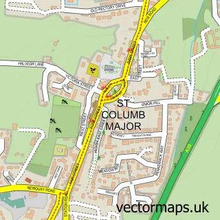
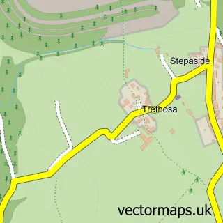
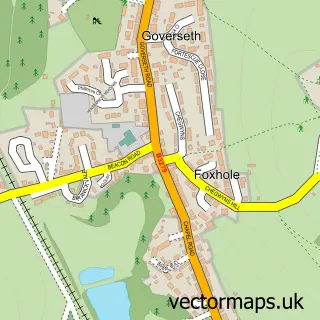
This Penhale street map is a detailed vector street map covering a 750m x 750m area. Select a larger area to create and download your own vector street map of Penhale.
The 750-metre map sample for Penhale covers 150 mapped buildings and approximately 13.7 km of road detail, of which 8 named roads are named. The immediate area includes 3 pubs and 1 MOT station, with 4 within 2 miles. The wider area around Penhale features 2 tourism points of interest, 8 food and drink venues and 2 hotels. To create a larger or custom map of Penhale, the map builder lets you define your own coverage area and download editable SVG, PDF and PNG files.
Create a larger editable map of Penhale
Choose any area you need and generate a high-quality vector map instantly. Perfect for print, planning, design, business and personal use.

This Penhale street map in Cornwall is available as downloadable SVG, PDF and PNG map files, or as a printed map for planning, business, display, education, local information and design work. You can also create a larger custom map area using the map selector.
What this Penhale map sample shows
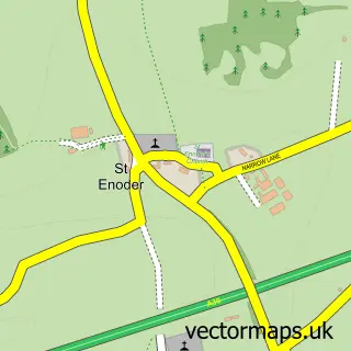
Penhale lies within St. Enoder Cp parish, part of St Enoder ward in the Cornwall local authority area. The postcode geography for this area includes the TR postcode area, the TR9 postcode district and the TR9 6 postcode sector. Residents fall under the Nhs Cornwall And The Isles Of Scilly Integrated Care Board for NHS services.
Local features near Penhale
Within 2 milesAmenities and services in and around Penhale.
Administrative and postcode information for Penhale
The local authority covering Penhale is Cornwall, within the county of Cornwall. The settlement lies within St Enoder ward and St. Enoder Cp civil parish. The TR9 postcode district and TR9 6 postcode sector serve the immediate area. NHS provision in the area is delivered through Royal Cornwall Hospitals Nhs Trust.
Nearby street map samples around Penhale

More street maps in Cornwall
750 metre map area coverage
Boundary, postcode and point of interest information for the 750m x 750m rectangle centred on this sample map.
Boundaries containing map centre
Constituency: St. Austell and Newquay Co Const
District: Cornwall
Icb: NHS Cornwall and the Isles of Scilly ICB
Parish: St. Enoder CP
Police Force: devon and cornwall
Postcode District: TR9
Postcode Sector: TR9 6
Nearby boundaries intersecting sample
Postcode District: TR8
Postcode Sector: TR8 5
Postcode coverage
POI category counts
Coffee Shop: 4
Department Store: 3
Driving School: 3
Pub: 3
Ev Charging Station: 2
Hotel: 2
Agricultural Service: 1
Automotive Services And Repair: 1
Beach: 1
Carpet Cleaning: 1
Sample points of interest
- Vincent Tractors & Plant
- Penhale Garage
- Perrenporth
- Shipshape
- TK Maxx
- Costa Coffee
- Costa Express
- Starbucks
- Starbucks UK
- Fraddon Village Hall
- Shell Select
- Boots
Create a larger editable map of Penhale
This sample shows only a 750 metre area. To create a larger map of Penhale, use our map builder to choose your own coverage area, add titles and download editable SVG, PDF and PNG files.
Create a custom map of Penhale