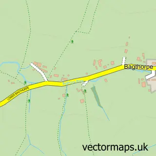
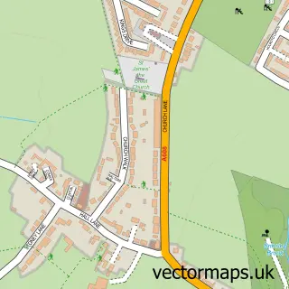
This Jacksdale street map is a detailed vector street map covering a 750m x 750m area. Select a larger area to create and download your own vector street map of Jacksdale.
The 750-metre map sample for Jacksdale covers 413 mapped buildings and approximately 20.4 km of road detail, of which 20 named roads are named. The immediate area includes 1 school, 1 GP surgery, with 3 within 2 miles, 3 pubs and 1 MOT station, with 10 within 2 miles. The wider area around Jacksdale features 1 tourism point of interest, 5 food and drink venues and 2 campsites within 2 miles. To create a larger or custom map of Jacksdale, the map builder lets you define your own coverage area and download editable SVG, PDF and PNG files.
Create a larger editable map of Jacksdale
Choose any area you need and generate a high-quality vector map instantly. Perfect for print, planning, design, business and personal use.

This Jacksdale street map in Nottinghamshire is available as downloadable SVG, PDF and PNG map files, or as a printed map for planning, business, display, education, local information and design work. You can also create a larger custom map area using the map selector.
What this Jacksdale map sample shows
Jacksdale lies within Ironville Cp parish, part of Ironville And Riddings ward in the Amber Valley District (B) local authority area. The postcode geography for this area includes the NG postcode area, the NG16 postcode district and the NG16 5 postcode sector. Residents fall under the Nhs Derby And Derbyshire Integrated Care Board for NHS services.
Local features near Jacksdale
Within 2 milesAmenities and services in and around Jacksdale.
Administrative and postcode information for Jacksdale
The local authority covering Jacksdale is Amber Valley District (B), within the county of Nottinghamshire. The settlement lies within Ironville And Riddings ward and Ironville Cp civil parish. The NG16 postcode district and NG16 5 postcode sector serve the immediate area. NHS provision in the area is delivered through University Hospitals Of Derby And Burton Nhs Foundation Trust.
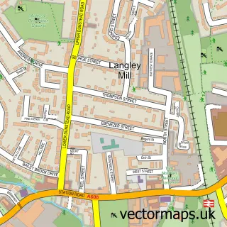
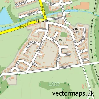
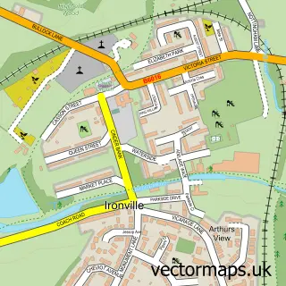
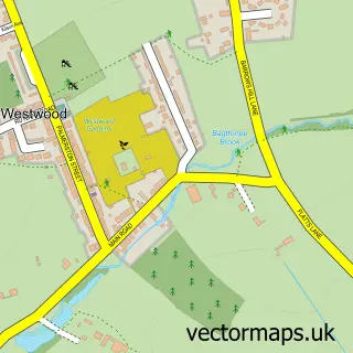
Nearby street map samples around Jacksdale


More street maps in Nottinghamshire
750 metre map area coverage
Boundary, postcode and point of interest information for the 750m x 750m rectangle centred on this sample map.
Boundaries containing map centre
Constituency: Ashfield Co Const
County: Nottinghamshire County
District: Ashfield District
Icb: NHS Nottingham and Nottinghamshire ICB
Parish: Selston CP
Police Force: nottinghamshire
Postcode District: NG16
Postcode Sector: NG16 5
Ward: Jacksdale & Westwood Ward
Nearby boundaries intersecting sample
Constituency: Amber Valley Co Const
County: Derbyshire County
District: Amber Valley District (B)
Icb: NHS Derby and Derbyshire ICB
Parish: Ironville CP
Police Force: derbyshire
Ward: Ironville & Riddings Ward
Postcode coverage
POI category counts
Dentist: 5
Professional Services: 3
Pub: 3
Retirement Home: 3
Barber: 2
Church Cathedral: 2
Contractor: 2
Elementary School: 2
Flowers And Gifts Shop: 2
Furniture Store: 2
Sample points of interest
- The Forge Jacksdale
- Brierley Therapies
- St Mary's Westwood
- Craft Supplies at number 23
- Brookside House
- Central England Co-Op - Jacksdale New Store (ERF)
- Chipmaster
- Jack's Bar
- Area Two Barber Shop
- LS Barbering
- Image hair and beauty
- Post Office-Jacksdale
Create a larger editable map of Jacksdale
This sample shows only a 750 metre area. To create a larger map of Jacksdale, use our map builder to choose your own coverage area, add titles and download editable SVG, PDF and PNG files.
Create a custom map of Jacksdale