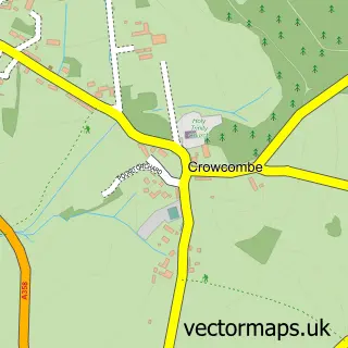
This Kilve street map is a detailed vector street map covering a 750m x 750m area. Select a larger area to create and download your own vector street map of Kilve.
The 750-metre map sample for Kilve covers 117 mapped buildings and approximately 7.7 km of road detail, of which 6 named roads are named. The immediate area includes 1 pub and 1 MOT station. The wider area around Kilve features 1 food and drink venue and 1 campsite within 2 miles. To create a larger or custom map of Kilve, the map builder lets you define your own coverage area and download editable SVG, PDF and PNG files.
Create a larger editable map of Kilve
Choose any area you need and generate a high-quality vector map instantly. Perfect for print, planning, design, business and personal use.

This Kilve street map in Somerset is available as downloadable SVG, PDF and PNG map files, or as a printed map for planning, business, display, education, local information and design work. You can also create a larger custom map area using the map selector.
What this Kilve map sample shows
Kilve lies within Kilve Cp parish, part of Quantock Vale ward in the Somerset local authority area. The postcode geography for this area includes the TA postcode area, the TA5 postcode district and the TA5 1 postcode sector. Residents fall under the Nhs Somerset Integrated Care Board for NHS services.
Local features near Kilve
Within 2 milesAmenities and services in and around Kilve.
Administrative and postcode information for Kilve
Kilve lies within Kilve Cp parish, part of Quantock Vale ward in the Somerset local authority area. The postcode geography for this area includes the TA postcode area, the TA5 postcode district and the TA5 1 postcode sector. Residents fall under the Nhs Somerset Integrated Care Board for NHS services.
Nearby street map samples around Kilve

More street maps in Somerset
750 metre map area coverage
Boundary, postcode and point of interest information for the 750m x 750m rectangle centred on this sample map.
Boundaries containing map centre
Constituency: Tiverton and Minehead Co Const
District: Somerset
Icb: NHS Somerset ICB
Parish: Kilve CP
Police Force: avon and somerset
Postcode District: TA5
Postcode Sector: TA5 1
Nearby boundaries intersecting sample
Parish: Holford CP
Postcode coverage
POI category counts
Automotive Repair: 3
Education: 2
Shipping Center: 2
Automotive Services And Repair: 1
Community Center: 1
Convenience Store: 1
Information Technology Company: 1
Pub: 1
Specialty School: 1
Sample points of interest
- C W Feltham
- C W Feltham Ltd
- Kilve Motor Repairs
- Hillwalk
- Kilve Village Hall
- Premier
- Kilve Court Residential Education Centre
- SSE Outdoors: Kilve Court, Charterhouse Centre, Great Wood, The ODC Kilve
- Hillwalk Ltd.
- The Hood Arms
- Kilve Post Office
- Post Office-Kilve
Create a larger editable map of Kilve
This sample shows only a 750 metre area. To create a larger map of Kilve, use our map builder to choose your own coverage area, add titles and download editable SVG, PDF and PNG files.
Create a custom map of Kilve