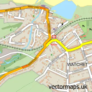
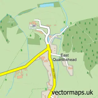
This West Quantoxhead street map is a detailed vector street map covering a 750m x 750m area. Select a larger area to create and download your own vector street map of West Quantoxhead.
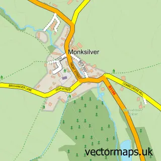
The 750-metre map sample for West Quantoxhead covers 153 mapped buildings and approximately 7.6 km of road detail, of which 7 named roads are named. The immediate area includes 1 GP surgery within 2 miles and 1 MOT station, with 4 within 2 miles. The wider area around West Quantoxhead features 1 tourism point of interest and 3 campsites within 2 miles. To create a larger or custom map of West Quantoxhead, the map builder lets you define your own coverage area and download editable SVG, PDF and PNG files.
Create a larger editable map of West Quantoxhead
Choose any area you need and generate a high-quality vector map instantly. Perfect for print, planning, design, business and personal use.

This West Quantoxhead street map in Somerset is available as downloadable SVG, PDF and PNG map files, or as a printed map for planning, business, display, education, local information and design work. You can also create a larger custom map area using the map selector.
What this West Quantoxhead map sample shows
West Quantoxhead lies within West Quantoxhead Cp parish, part of Quantock Vale ward in the Somerset local authority area. The postcode geography for this area includes the TA postcode area, the TA4 postcode district and the TA4 4 postcode sector. Residents fall under the Nhs Somerset Integrated Care Board for NHS services.
Local features near West Quantoxhead
Within 2 milesAmenities and services in and around West Quantoxhead.
Administrative and postcode information for West Quantoxhead
West Quantoxhead lies within West Quantoxhead Cp parish, part of Quantock Vale ward in the Somerset local authority area. The postcode geography for this area includes the TA postcode area, the TA4 postcode district and the TA4 4 postcode sector. Residents fall under the Nhs Somerset Integrated Care Board for NHS services.
Nearby street map samples around West Quantoxhead

More street maps in Somerset
750 metre map area coverage
Boundary, postcode and point of interest information for the 750m x 750m rectangle centred on this sample map.
Boundaries containing map centre
Constituency: Tiverton and Minehead Co Const
District: Somerset
Icb: NHS Somerset ICB
Parish: West Quantoxhead CP
Police Force: avon and somerset
Postcode District: TA4
Postcode Sector: TA4 4
Nearby boundaries intersecting sample
No additional intersecting boundaries found.
Postcode coverage
POI category counts
Convenience Store: 2
Gas Station: 2
Laundromat: 2
Auto Electrical Repair: 1
Automotive Repair: 1
Beauty And Spa: 1
Bed And Breakfast: 1
Cabin: 1
Cosmetic And Beauty Supplies: 1
Inn: 1
Sample points of interest
- Jago Electrical Contractors
- West Quantoxhead Motor Services
- Emma Sheppard PMU Artist, Microblading & Beauty Therapist
- Stilegate Guest House
- Moonfleat Cottage
- Premier
- Premier St Audries Service Station
- Skincareme
- Murco
- St Audries Service Station - Murco
- The Windmill Inn
- Kis Wash
Create a larger editable map of West Quantoxhead
This sample shows only a 750 metre area. To create a larger map of West Quantoxhead, use our map builder to choose your own coverage area, add titles and download editable SVG, PDF and PNG files.
Create a custom map of West Quantoxhead