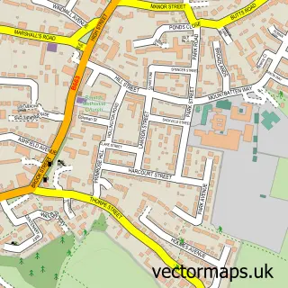
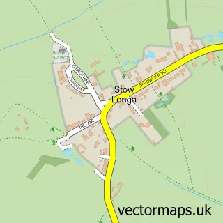
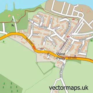
This Kimbolton street map is a detailed vector street map covering a 750m x 750m area. Select a larger area to create and download your own vector street map of Kimbolton.
The 750-metre map sample for Kimbolton covers 214 mapped buildings and approximately 6.5 km of road detail, of which 14 named roads are named. The immediate area includes 2 schools, 1 GP surgery within 2 miles and 1 MOT station. The wider area around Kimbolton features 1 tourism point of interest, 2 food and drink venues and 1 hotel. To create a larger or custom map of Kimbolton, the map builder lets you define your own coverage area and download editable SVG, PDF and PNG files.
Create a larger editable map of Kimbolton
Choose any area you need and generate a high-quality vector map instantly. Perfect for print, planning, design, business and personal use.

This Kimbolton street map in Cambridgeshire is available as downloadable SVG, PDF and PNG map files, or as a printed map for planning, business, display, education, local information and design work. You can also create a larger custom map area using the map selector.
What this Kimbolton map sample shows
Kimbolton lies within Kimbolton Cp parish, part of Kimbolton ward in the Huntingdonshire District local authority area. The postcode geography for this area includes the PE postcode area, the PE28 postcode district and the PE28 0 postcode sector. Residents fall under the Nhs Cambridgeshire And Peterborough Integrated Care Board for NHS services.
Local features near Kimbolton
Within 2 milesAmenities and services in and around Kimbolton.
Administrative and postcode information for Kimbolton
The local authority covering Kimbolton is Huntingdonshire District, within the county of Cambridgeshire. The settlement lies within Kimbolton ward and Kimbolton Cp civil parish. The PE28 postcode district and PE28 0 postcode sector serve the immediate area. NHS provision in the area is delivered through North West Anglia Nhs Foundation Trust.
Nearby street map samples around Kimbolton

More street maps in Cambridgeshire
750 metre map area coverage
Boundary, postcode and point of interest information for the 750m x 750m rectangle centred on this sample map.
Boundaries containing map centre
Constituency: Huntingdon Co Const
County: Cambridgeshire County
District: Huntingdonshire District
Icb: NHS Central East ICB
Parish: Kimbolton CP
Police Force: cambridgeshire
Postcode District: PE28
Postcode Sector: PE28 0
Ward: Kimbolton Ward
Nearby boundaries intersecting sample
Postcode District: PE19
Postcode Sector: PE19 5
Postcode coverage
POI category counts
Beauty And Spa: 3
Financial Advising: 3
Butcher Shop: 2
Gift Shop: 2
Real Estate Agent: 2
Anglican Church: 1
Arts And Crafts: 1
Atms: 1
Auto Electrical Repair: 1
Beauty Salon: 1
Sample points of interest
- St Andrew's Church
- Purlwise
- PayPoint
- John Sinclair Electrical
- ALL NATURAL SOAP Co
- Amanda Allport Clinic
- Beauty Crewe
- Courtyard Beauty
- Carters Yard Bed and Breakfast
- Hutchinsons
- H Hellett & Sons
- Hellett and Sons
Create a larger editable map of Kimbolton
This sample shows only a 750 metre area. To create a larger map of Kimbolton, use our map builder to choose your own coverage area, add titles and download editable SVG, PDF and PNG files.
Create a custom map of Kimbolton