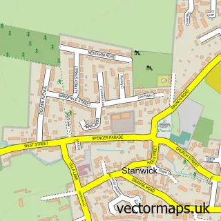
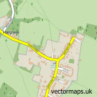
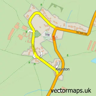
This Raunds street map is a detailed vector street map covering a 750m x 750m area. Select a larger area to create and download your own vector street map of Raunds.
The 750-metre map sample for Raunds covers 520 mapped buildings and approximately 27.1 km of road detail, of which 46 named roads are named. The immediate area includes 2 primary schools and 1 secondary school, 1 GP surgery, with 2 within 2 miles, 2 pubs and 3 MOT stations within 2 miles. The wider area around Raunds features 8 food and drink venues. To create a larger or custom map of Raunds, the map builder lets you define your own coverage area and download editable SVG, PDF and PNG files.
Create a larger editable map of Raunds
Choose any area you need and generate a high-quality vector map instantly. Perfect for print, planning, design, business and personal use.

This Raunds street map in Northamptonshire is available as downloadable SVG, PDF and PNG map files, or as a printed map for planning, business, display, education, local information and design work. You can also create a larger custom map area using the map selector.
What this Raunds map sample shows
Raunds lies within Raunds Cp parish, part of Raunds Saxon ward in the North Northamptonshire local authority area. The postcode geography for this area includes the NN postcode area, the NN9 postcode district and the NN9 6 postcode sector. Residents fall under the Nhs Northamptonshire Integrated Care Board for NHS services.
Local features near Raunds
Within 2 milesAmenities and services in and around Raunds.
Administrative and postcode information for Raunds
The local authority covering Raunds is North Northamptonshire, within the county of Northamptonshire. The settlement lies within Raunds Saxon ward and Raunds Cp civil parish. The NN9 postcode district and NN9 6 postcode sector serve the immediate area. NHS provision in the area is delivered through Kettering General Hospital Nhs Foundation Trust.
Nearby street map samples around Raunds

More street maps in Northamptonshire
750 metre map area coverage
Boundary, postcode and point of interest information for the 750m x 750m rectangle centred on this sample map.
Boundaries containing map centre
Constituency: Corby and East Northamptonshire Co Const
District: North Northamptonshire
Icb: NHS Northamptonshire ICB
Parish: Raunds CP
Police Force: northamptonshire
Postcode District: NN9
Postcode Sector: NN9 6
Ward: Raunds Ward
Nearby boundaries intersecting sample
No additional intersecting boundaries found.
Postcode coverage
POI category counts
Hair Salon: 6
Barber: 5
Professional Services: 5
Beauty Salon: 4
Cafe: 4
Convenience Store: 4
Bar: 3
Dog Walkers: 3
Elementary School: 3
Funeral Services And Cemeteries: 3
Sample points of interest
- Creative Beast
- Promote It
- Cat Protection League
- Raunds Antiques And Collectables
- Archers of Raunds
- Andrew Porter Architectural Consultant
- Central England Co-Op - Raunds
- Central Garage
- Cookies Bakers And Confectioners LTD.
- Greggs
- NatWest
- Jester's Bistro Bar
Create a larger editable map of Raunds
This sample shows only a 750 metre area. To create a larger map of Raunds, use our map builder to choose your own coverage area, add titles and download editable SVG, PDF and PNG files.
Create a custom map of Raunds