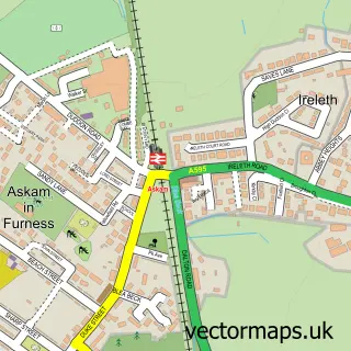
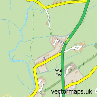
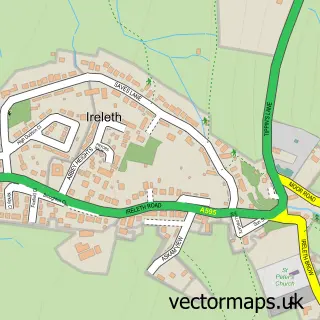
This Kirkby-in-Furness street map is a detailed vector street map covering a 750m x 750m area. Select a larger area to create and download your own vector street map of Kirkby-in-Furness.
The 750-metre map sample for Kirkby-in-Furness covers 160 mapped buildings and approximately 8.2 km of road detail, of which 2 named roads are named. The immediate area includes 1 school, 1 railway station, 1 GP surgery and 2 pubs among other local services. The wider area around Kirkby-in-Furness features 3 food and drink venues. To create a larger or custom map of Kirkby-in-Furness, the map builder lets you define your own coverage area and download editable SVG, PDF and PNG files.
Create a larger editable map of Kirkby-in-Furness
Choose any area you need and generate a high-quality vector map instantly. Perfect for print, planning, design, business and personal use.

This Kirkby-in-Furness street map in Cumbria is available as downloadable SVG, PDF and PNG map files, or as a printed map for planning, business, display, education, local information and design work. You can also create a larger custom map area using the map selector.
What this Kirkby-in-Furness map sample shows
Kirkby-in-Furness lies within Kirkby Ireleth Cp parish, part of Broughton & Coniston ward in the Westmorland And Furness local authority area. The postcode geography for this area includes the LA postcode area, the LA17 postcode district and the LA17 7 postcode sector. Residents fall under the Nhs Lancashire And South Cumbria Integrated Care Board for NHS services.
Local features near Kirkby-in-Furness
Within 2 milesAmenities and services in and around Kirkby-in-Furness.
Administrative and postcode information for Kirkby-in-Furness
Kirkby-in-Furness lies within Kirkby Ireleth Cp parish, part of Broughton & Coniston ward in the Westmorland And Furness local authority area. The postcode geography for this area includes the LA postcode area, the LA17 postcode district and the LA17 7 postcode sector. Residents fall under the Nhs Lancashire And South Cumbria Integrated Care Board for NHS services.
Nearby street map samples around Kirkby-in-Furness

More street maps in Cumbria
750 metre map area coverage
Boundary, postcode and point of interest information for the 750m x 750m rectangle centred on this sample map.
Boundaries containing map centre
Constituency: Barrow and Furness Co Const
District: Westmorland and Furness
Icb: NHS Lancashire and South Cumbria ICB
Parish: Kirkby Ireleth CP
Police Force: cumbria
Postcode District: LA17
Postcode Sector: LA17 7
Ward: High Furness Ward
Nearby boundaries intersecting sample
Parish: Angerton CP
Postcode coverage
POI category counts
Post Office: 2
Pub: 2
Anglican Church: 1
Automotive Repair: 1
Bar: 1
Cafe: 1
Community Center: 1
Doctor: 1
Holiday Rental Home: 1
Train Station: 1
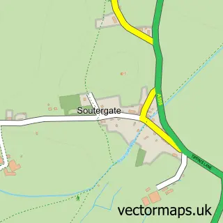
Sample points of interest
- St Cuthbert's
- Moorland Service Station
- Burlington Inn
- Pam's Café
- Kirkby Community Centre
- Duddon Valley Medical Practice
- Halsteads
- Moorland Stores & Post Office
- Post Office-Kirkby-in-Furness
- The Commercial
- The Ship Inn
- Kirkby-in-Furness Railway Station (KBF)
Create a larger editable map of Kirkby-in-Furness
This sample shows only a 750 metre area. To create a larger map of Kirkby-in-Furness, use our map builder to choose your own coverage area, add titles and download editable SVG, PDF and PNG files.
Create a custom map of Kirkby-in-Furness