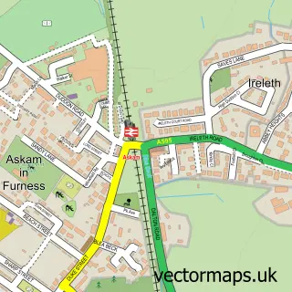
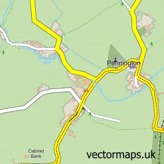
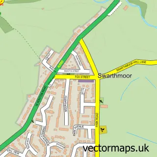
This Ireleth street map is a detailed vector street map covering a 750m x 750m area. Select a larger area to create and download your own vector street map of Ireleth.
The 750-metre map sample for Ireleth covers 264 mapped buildings and approximately 10.8 km of road detail, of which 15 named roads are named. The immediate area includes 1 school and 1 MOT station within 2 miles. To create a larger or custom map of Ireleth, the map builder lets you define your own coverage area and download editable SVG, PDF and PNG files.
Create a larger editable map of Ireleth
Choose any area you need and generate a high-quality vector map instantly. Perfect for print, planning, design, business and personal use.

This Ireleth street map in Cumbria is available as downloadable SVG, PDF and PNG map files, or as a printed map for planning, business, display, education, local information and design work. You can also create a larger custom map area using the map selector.
What this Ireleth map sample shows
Ireleth lies within Askam And Ireleth Cp parish, part of Dalton North ward in the Westmorland And Furness local authority area. The postcode geography for this area includes the LA postcode area, the LA16 postcode district and the LA16 7 postcode sector. Residents fall under the Nhs Lancashire And South Cumbria Integrated Care Board for NHS services.
Local features near Ireleth
Within 2 milesAmenities and services in and around Ireleth.
Administrative and postcode information for Ireleth
Ireleth lies within Askam And Ireleth Cp parish, part of Dalton North ward in the Westmorland And Furness local authority area. The postcode geography for this area includes the LA postcode area, the LA16 postcode district and the LA16 7 postcode sector. Residents fall under the Nhs Lancashire And South Cumbria Integrated Care Board for NHS services.
Nearby street map samples around Ireleth

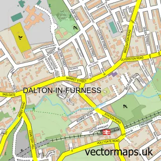
More street maps in Cumbria
750 metre map area coverage
Boundary, postcode and point of interest information for the 750m x 750m rectangle centred on this sample map.
Boundaries containing map centre
Constituency: Barrow and Furness Co Const
District: Westmorland and Furness
Icb: NHS Lancashire and South Cumbria ICB
Parish: Askam and Ireleth CP
Police Force: cumbria
Postcode District: LA16
Postcode Sector: LA16 7
Ward: Dalton North Ward
Nearby boundaries intersecting sample
No additional intersecting boundaries found.
Postcode coverage
POI category counts
Convenience Store: 2
Driving School: 2
Elementary School: 2
Anglican Church: 1
Assisted Living Facility: 1
Automotive Repair: 1
Community Center: 1
Community Services Non Profits: 1
Glass Manufacturer: 1
Hvac Services: 1
Sample points of interest
- St Peter
- Vicarage Care
- Furness Cars & Commercials Limited
- Askam and Ireleth Community Centre Limited
- Ireleth Temperance Hall
- Costcutter
- Ireleth Village Store
- The Driving Instructor
- Xl Driver Training
- Ireleth St Peter's CofE Primary School
- Ireleth St Peters C of E Primary School
- Lakes Art Glass
Create a larger editable map of Ireleth
This sample shows only a 750 metre area. To create a larger map of Ireleth, use our map builder to choose your own coverage area, add titles and download editable SVG, PDF and PNG files.
Create a custom map of Ireleth