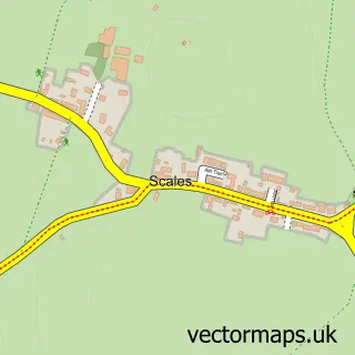
This Lindal-in-Furness street map is a detailed vector street map covering a 750m x 750m area. Select a larger area to create and download your own vector street map of Lindal-in-Furness.
The 750-metre map sample for Lindal-in-Furness covers 150 mapped buildings and approximately 12.9 km of road detail, of which 11 named roads are named. The immediate area includes 1 GP surgery within 2 miles, 1 pub and 5 MOT stations within 2 miles. The wider area around Lindal-in-Furness features 1 food and drink venue. To create a larger or custom map of Lindal-in-Furness, the map builder lets you define your own coverage area and download editable SVG, PDF and PNG files.
Create a larger editable map of Lindal-in-Furness
Choose any area you need and generate a high-quality vector map instantly. Perfect for print, planning, design, business and personal use.

This Lindal-in-Furness street map in Cumbria is available as downloadable SVG, PDF and PNG map files, or as a printed map for planning, business, display, education, local information and design work. You can also create a larger custom map area using the map selector.
What this Lindal-in-Furness map sample shows
Lindal-in-Furness lies within Lindal And Marton Cp parish, part of Dalton North ward in the Westmorland And Furness local authority area. The postcode geography for this area includes the LA postcode area, the LA12 postcode district and the LA12 0 postcode sector. Residents fall under the Nhs Lancashire And South Cumbria Integrated Care Board for NHS services.
Local features near Lindal-in-Furness
Within 2 milesAmenities and services in and around Lindal-in-Furness.
Administrative and postcode information for Lindal-in-Furness
Lindal-in-Furness lies within Lindal And Marton Cp parish, part of Dalton North ward in the Westmorland And Furness local authority area. The postcode geography for this area includes the LA postcode area, the LA12 postcode district and the LA12 0 postcode sector. Residents fall under the Nhs Lancashire And South Cumbria Integrated Care Board for NHS services.
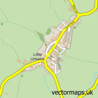
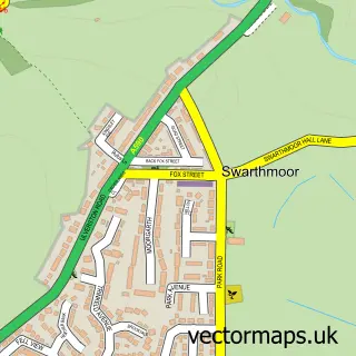
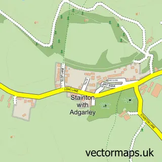
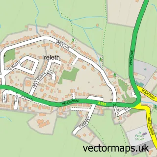
Nearby street map samples around Lindal-in-Furness

More street maps in Cumbria
750 metre map area coverage
Boundary, postcode and point of interest information for the 750m x 750m rectangle centred on this sample map.
Boundaries containing map centre
Constituency: Barrow and Furness Co Const
District: Westmorland and Furness
Icb: NHS Lancashire and South Cumbria ICB
Parish: Lindal and Marton CP
Police Force: cumbria
Postcode District: LA12
Postcode Sector: LA12 0
Ward: Dalton North Ward
Nearby boundaries intersecting sample
Parish: Pennington CP, Urswick CP
Ward: High Furness Ward, Low Furness Ward
Postcode coverage
POI category counts
Butcher Shop: 2
Anglican Church: 1
Automotive Repair: 1
Beauty Salon: 1
Beverage Store: 1
Cricket Ground: 1
Eat And Drink: 1
Engineering Services: 1
Fitness Trainer: 1
Pub: 1
Sample points of interest
- St Peter's Lindal with Marton
- Cumbria Agricultural Services
- Kurly's
- Frederic Robinson
- Dish & Drink Delight
- Lake District Farmers
- Lindal Moor Cricket Club
- M&S Foodhall - Ulverston
- I.T. Shaw Ltd
- Furness Active
- Railway Inn
- Ulverston News
Create a larger editable map of Lindal-in-Furness
This sample shows only a 750 metre area. To create a larger map of Lindal-in-Furness, use our map builder to choose your own coverage area, add titles and download editable SVG, PDF and PNG files.
Create a custom map of Lindal-in-Furness