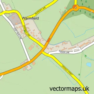
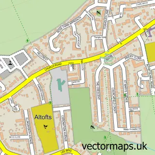
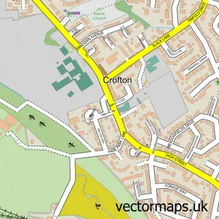
This Kirkthorpe street map is a detailed vector street map covering a 750m x 750m area. Select a larger area to create and download your own vector street map of Kirkthorpe.
The 750-metre map sample for Kirkthorpe covers 107 mapped buildings and approximately 4.5 km of road detail, of which 7 named roads are named. The immediate area includes 7 GP surgeries within 2 miles and 14 MOT stations within 2 miles. The wider area around Kirkthorpe features 1 tourism point of interest. To create a larger or custom map of Kirkthorpe, the map builder lets you define your own coverage area and download editable SVG, PDF and PNG files.
Create a larger editable map of Kirkthorpe
Choose any area you need and generate a high-quality vector map instantly. Perfect for print, planning, design, business and personal use.

This Kirkthorpe street map in West Yorkshire is available as downloadable SVG, PDF and PNG map files, or as a printed map for planning, business, display, education, local information and design work. You can also create a larger custom map area using the map selector.
What this Kirkthorpe map sample shows
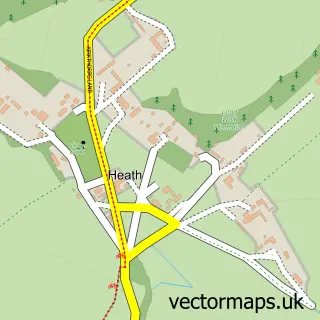
Kirkthorpe lies within Warmfield Cum Heath Cp parish, part of Normanton ward in the Wakefield District (B) local authority area. The postcode geography for this area includes the WF postcode area, the WF1 postcode district and the WF1 5 postcode sector. Residents fall under the Nhs West Yorkshire Integrated Care Board for NHS services.
Local features near Kirkthorpe
Within 2 milesAmenities and services in and around Kirkthorpe.
Administrative and postcode information for Kirkthorpe
The local authority covering Kirkthorpe is Wakefield District (B), within the county of West Yorkshire. The settlement lies within Normanton ward and Warmfield Cum Heath Cp civil parish. The WF1 postcode district and WF1 5 postcode sector serve the immediate area. NHS provision in the area is delivered through Mid Yorkshire Teaching Nhs Trust.
Nearby street map samples around Kirkthorpe
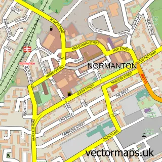

More street maps in West Yorkshire
750 metre map area coverage
Boundary, postcode and point of interest information for the 750m x 750m rectangle centred on this sample map.
Boundaries containing map centre
Constituency: Normanton and Hemsworth Co Const
District: Wakefield District (B)
Icb: NHS West Yorkshire ICB
Parish: Warmfield cum Heath CP
Police Force: west yorkshire
Postcode District: WF1
Postcode Sector: WF1 5
Ward: Normanton Ward
Nearby boundaries intersecting sample
No additional intersecting boundaries found.
Postcode coverage
POI category counts
Advertising Agency: 1
Business: 1
Flowers And Gifts Shop: 1
Landmark And Historical Building: 1
Marketing Consultant: 1
Printing Services: 1
Shopping Center: 1
Sample points of interest
- Local Marketing Wizard
- FREE Web Design Agency
- Customised by Sharon
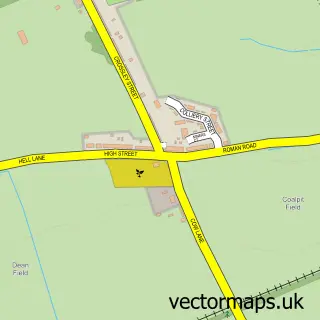
- Kirkthorpe
- Nitro Seo
- Morley Community Archives
- Ridings Center Wakefield
Create a larger editable map of Kirkthorpe
This sample shows only a 750 metre area. To create a larger map of Kirkthorpe, use our map builder to choose your own coverage area, add titles and download editable SVG, PDF and PNG files.
Create a custom map of Kirkthorpe