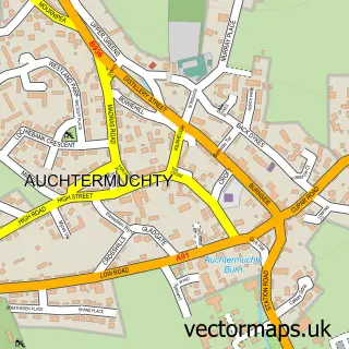
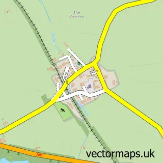
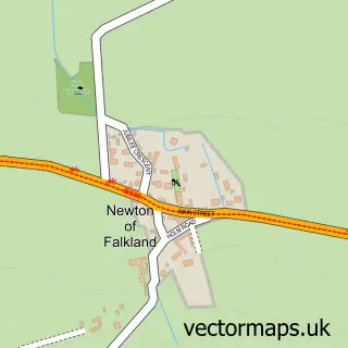
This Ladybank street map is a detailed vector street map covering a 750m x 750m area. Select a larger area to create and download your own vector street map of Ladybank.
The 750-metre map sample for Ladybank covers 171 mapped buildings and approximately 12.2 km of road detail, of which 23 named roads are named. The immediate area includes 1 GP surgery within 2 miles, 1 pub and 1 MOT station, with 2 within 2 miles. The wider area around Ladybank features 3 tourism points of interest and 1 food and drink venue. To create a larger or custom map of Ladybank, the map builder lets you define your own coverage area and download editable SVG, PDF and PNG files.
Create a larger editable map of Ladybank
Choose any area you need and generate a high-quality vector map instantly. Perfect for print, planning, design, business and personal use.

This Ladybank street map in Fife is available as downloadable SVG, PDF and PNG map files, or as a printed map for planning, business, display, education, local information and design work. You can also create a larger custom map area using the map selector.
What this Ladybank map sample shows
Ladybank lies within Fife parish, part of Howe Of Fife And Tay Coast ward in the Fife local authority area. The postcode geography for this area includes the KY postcode area, the KY15 postcode district and the KY15 7 postcode sector. Residents fall under the Fife for NHS services.
Local features near Ladybank
Within 2 milesAmenities and services in and around Ladybank.
Administrative and postcode information for Ladybank
Ladybank lies within Fife parish, part of Howe Of Fife And Tay Coast ward in the Fife local authority area. The postcode geography for this area includes the KY postcode area, the KY15 postcode district and the KY15 7 postcode sector. Residents fall under the Fife for NHS services.
Nearby street map samples around Ladybank

More street maps in Fife
750 metre map area coverage
Boundary, postcode and point of interest information for the 750m x 750m rectangle centred on this sample map.
Boundaries containing map centre
Constituency: North East Fife Co Const
District: Fife
Icb: Fife
Postcode District: KY15
Postcode Sector: KY15 7
Ward: Howe of Fife and Tay Coast Ward
Nearby boundaries intersecting sample
No additional intersecting boundaries found.
Postcode coverage
POI category counts
Automotive Repair: 3
Park: 3
Driving School: 2
Professional Services: 2
Appliance Manufacturer: 1
Auto Loan Provider: 1
Bakery: 1
Bar: 1
Beauty Salon: 1
Building Supply Store: 1
Sample points of interest
- Images Stained Glass Services
- First Mortgage Solutions
- Ian Sim 4x4 Ltd
- Mike Aitken 4 X 4
- S P Motors
- Allison's Wee Bake Hut
- Ladybank Tavern
- Dawn Anderson Beauty & Nails
- Chris Brown Joinery
- Ladybank Gospel Hall
- Haud Yer Wheesht Silent Disco
- PHIL Smith Driving School
Create a larger editable map of Ladybank
This sample shows only a 750 metre area. To create a larger map of Ladybank, use our map builder to choose your own coverage area, add titles and download editable SVG, PDF and PNG files.
Create a custom map of Ladybank