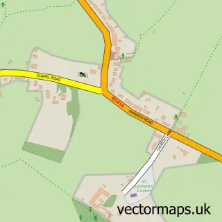
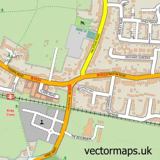
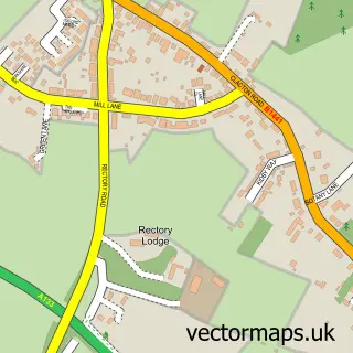
This Landermere street map is a detailed vector street map covering a 750m x 750m area. Select a larger area to create and download your own vector street map of Landermere.
The 750-metre map sample for Landermere covers 24 mapped buildings and approximately 7.2 km of road detail, of which 2 named roads are named. The immediate area includes 1 GP surgery within 2 miles and 3 MOT stations within 2 miles. The wider area around Landermere features 1 campsite within 2 miles. To create a larger or custom map of Landermere, the map builder lets you define your own coverage area and download editable SVG, PDF and PNG files.
Create a larger editable map of Landermere
Choose any area you need and generate a high-quality vector map instantly. Perfect for print, planning, design, business and personal use.

This Landermere street map in Essex is available as downloadable SVG, PDF and PNG map files, or as a printed map for planning, business, display, education, local information and design work. You can also create a larger custom map area using the map selector.
What this Landermere map sample shows
Landermere lies within Thorpe-Le-Soken Cp parish, part of Thorpe, Beaumont & Great Holland ward in the Tendring District local authority area. The postcode geography for this area includes the CO postcode area, the CO16 postcode district and the CO16 0 postcode sector. Residents fall under the Nhs Suffolk And North East Essex Integrated Care Board for NHS services.
Local features near Landermere
Within 2 milesAmenities and services in and around Landermere.
Administrative and postcode information for Landermere
The local authority covering Landermere is Tendring District, within the county of Essex. The settlement lies within Thorpe, Beaumont & Great Holland ward and Thorpe-Le-Soken Cp civil parish. The CO16 postcode district and CO16 0 postcode sector serve the immediate area. NHS provision in the area is delivered through East Suffolk And North Essex Nhs Foundation Trust.
Nearby street map samples around Landermere

More street maps in Essex
750 metre map area coverage
Boundary, postcode and point of interest information for the 750m x 750m rectangle centred on this sample map.
Boundaries containing map centre
Constituency: Clacton Co Const
County: Essex County
District: Tendring District
Icb: NHS Essex ICB
Parish: Thorpe-le-Soken CP
Police Force: essex
Postcode District: CO16
Postcode Sector: CO16 0
Ward: Thorpe, Beaumont & Great Holland Ward
Nearby boundaries intersecting sample
No additional intersecting boundaries found.
Postcode coverage
POI category counts
Kitchen And Bath: 2
Appliance Store: 1
Auto Body Shop: 1
Contractor: 1
Distillery: 1
Home Developer: 1
Interior Design: 1
Professional Services: 1
Sample points of interest
- EcoSmart Appliances
- Anglian Vehicle Linings
- CK Stone Limited
- East Coast Distillery
- Leaperland Promotion
- Francie Readman Interiors
- C K Stone Ltd.
- CKStone Ltd.
- Anglian Vehicle Linings
Create a larger editable map of Landermere
This sample shows only a 750 metre area. To create a larger map of Landermere, use our map builder to choose your own coverage area, add titles and download editable SVG, PDF and PNG files.
Create a custom map of Landermere