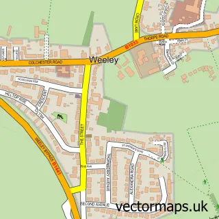
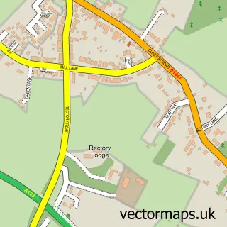
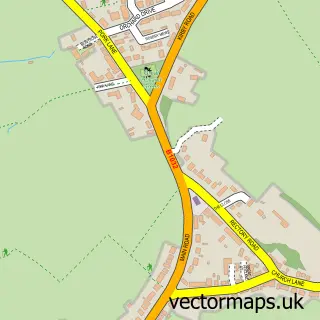
This Thorpe-le-Soken street map is a detailed vector street map covering a 750m x 750m area. Select a larger area to create and download your own vector street map of Thorpe-le-Soken.
The 750-metre map sample for Thorpe-le-Soken covers 427 mapped buildings and approximately 9.8 km of road detail, of which 17 named roads are named. The immediate area includes 1 school, 1 GP surgery, 2 pubs and 2 MOT stations within 2 miles. The wider area around Thorpe-le-Soken features 3 food and drink venues and 1 campsite within 2 miles. To create a larger or custom map of Thorpe-le-Soken, the map builder lets you define your own coverage area and download editable SVG, PDF and PNG files.
Create a larger editable map of Thorpe-le-Soken
Choose any area you need and generate a high-quality vector map instantly. Perfect for print, planning, design, business and personal use.

This Thorpe-le-Soken street map in Essex is available as downloadable SVG, PDF and PNG map files, or as a printed map for planning, business, display, education, local information and design work. You can also create a larger custom map area using the map selector.
What this Thorpe-le-Soken map sample shows
Thorpe-le-Soken lies within Thorpe-Le-Soken Cp parish, part of Thorpe, Beaumont & Great Holland ward in the Tendring District local authority area. The postcode geography for this area includes the CO postcode area, the CO16 postcode district and the CO16 0 postcode sector. Residents fall under the Nhs Suffolk And North East Essex Integrated Care Board for NHS services.
Local features near Thorpe-le-Soken
Within 2 milesAmenities and services in and around Thorpe-le-Soken.
Administrative and postcode information for Thorpe-le-Soken
Thorpe-le-Soken lies within Thorpe-Le-Soken Cp parish, part of Thorpe, Beaumont & Great Holland ward in the Tendring District local authority area. The postcode geography for this area includes the CO postcode area, the CO16 postcode district and the CO16 0 postcode sector. Residents fall under the Nhs Suffolk And North East Essex Integrated Care Board for NHS services.
Nearby street map samples around Thorpe-le-Soken

More street maps in Essex
750 metre map area coverage
Boundary, postcode and point of interest information for the 750m x 750m rectangle centred on this sample map.
Boundaries containing map centre
Constituency: Clacton Co Const
County: Essex County
District: Tendring District
Icb: NHS Essex ICB
Parish: Thorpe-le-Soken CP
Police Force: essex
Postcode District: CO16
Postcode Sector: CO16 0
Ward: Thorpe, Beaumont & Great Holland Ward
Nearby boundaries intersecting sample
No additional intersecting boundaries found.
Postcode coverage
POI category counts
Bed And Breakfast: 3
Education: 3
Automotive: 2
Beauty And Spa: 2
Beauty Salon: 2
Electrician: 2
Elementary School: 2
Hair Salon: 2
Jewelry Store: 2
Professional Services: 2
Sample points of interest
- Thorpe-le-Soken: St Michael
- Essex Cars Wanted
- M & T Motors
- Danielle Round special cakes shop
- 1 SKIIN
- Clair Jackson Hair
- Exclusive
- Woohoo
- The Bell Inn Bistro
- The Rose And Crown
- The Rose And Crown
- The Olive Branch
Create a larger editable map of Thorpe-le-Soken
This sample shows only a 750 metre area. To create a larger map of Thorpe-le-Soken, use our map builder to choose your own coverage area, add titles and download editable SVG, PDF and PNG files.
Create a custom map of Thorpe-le-Soken