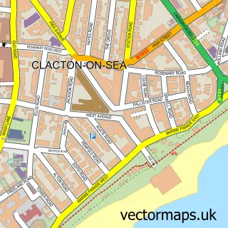
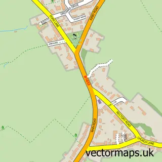
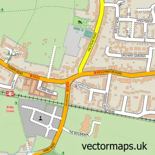
This Little Clacton street map is a detailed vector street map covering a 750m x 750m area. Select a larger area to create and download your own vector street map of Little Clacton.
The 750-metre map sample for Little Clacton covers 437 mapped buildings and approximately 10.2 km of road detail, of which 16 named roads are named. The immediate area includes 1 school, 2 GP surgeries within 2 miles, 2 pubs and 1 MOT station, with 17 within 2 miles. The wider area around Little Clacton features 2 tourism points of interest and 2 food and drink venues. To create a larger or custom map of Little Clacton, the map builder lets you define your own coverage area and download editable SVG, PDF and PNG files.
Create a larger editable map of Little Clacton
Choose any area you need and generate a high-quality vector map instantly. Perfect for print, planning, design, business and personal use.

This Little Clacton street map in Essex is available as downloadable SVG, PDF and PNG map files, or as a printed map for planning, business, display, education, local information and design work. You can also create a larger custom map area using the map selector.
What this Little Clacton map sample shows
Little Clacton lies within Little Clacton Cp parish, part of Little Clacton ward in the Tendring District local authority area. The postcode geography for this area includes the CO postcode area, the CO16 postcode district and the CO16 9 postcode sector. Residents fall under the Nhs Suffolk And North East Essex Integrated Care Board for NHS services.
Local features near Little Clacton
Within 2 milesAmenities and services in and around Little Clacton.
Administrative and postcode information for Little Clacton
Little Clacton lies within Little Clacton Cp parish, part of Little Clacton ward in the Tendring District local authority area. The postcode geography for this area includes the CO postcode area, the CO16 postcode district and the CO16 9 postcode sector. Residents fall under the Nhs Suffolk And North East Essex Integrated Care Board for NHS services.
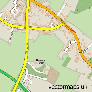
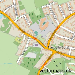
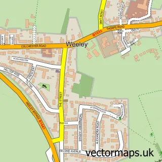
Nearby street map samples around Little Clacton

More street maps in Essex
750 metre map area coverage
Boundary, postcode and point of interest information for the 750m x 750m rectangle centred on this sample map.
Boundaries containing map centre
Constituency: Clacton Co Const
County: Essex County
District: Tendring District
Icb: NHS Essex ICB
Parish: Little Clacton CP
Police Force: essex
Postcode District: CO16
Postcode Sector: CO16 9
Ward: Little Clacton Ward
Nearby boundaries intersecting sample
No additional intersecting boundaries found.
Postcode coverage
POI category counts
Professional Services: 3
Beauty Salon: 2
Campground: 2
Flowers And Gifts Shop: 2
Pharmacy: 2
Post Office: 2
Pub: 2
Used Car Dealer: 2
Anglican Church: 1
Architect: 1
Sample points of interest
- Little Clacton: St James
- Beverley Ann Design | Architecture I Planning I House Extension
- Idesign Workwear
- Ling Chinese Entertainments
- PayPoint
- Pub on the Park
- Harold Lilley Playing Field
- Danielle Russell Mobile Footcare
- A Beautiful Look
- EnvyEnhancements
- Simply Sweet Candy Co
- Brian's Maintenance
Create a larger editable map of Little Clacton
This sample shows only a 750 metre area. To create a larger map of Little Clacton, use our map builder to choose your own coverage area, add titles and download editable SVG, PDF and PNG files.
Create a custom map of Little Clacton