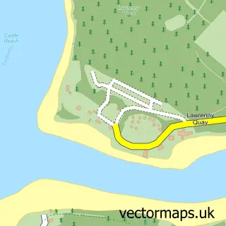
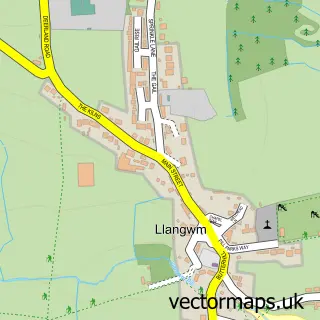
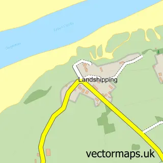
This Lawrenny street map is a detailed vector street map covering a 750m x 750m area. Select a larger area to create and download your own vector street map of Lawrenny.
The 750-metre map sample for Lawrenny covers 49 mapped buildings and approximately 7.1 km of road detail, of which 1 named road are named. The wider area around Lawrenny features 1 tourism point of interest, 2 food and drink venues and 1 hotel. To create a larger or custom map of Lawrenny, the map builder lets you define your own coverage area and download editable SVG, PDF and PNG files.
Create a larger editable map of Lawrenny
Choose any area you need and generate a high-quality vector map instantly. Perfect for print, planning, design, business and personal use.

This Lawrenny street map in Dyfed is available as downloadable SVG, PDF and PNG map files, or as a printed map for planning, business, display, education, local information and design work. You can also create a larger custom map area using the map selector.
What this Lawrenny map sample shows
Lawrenny lies within Martletwy Community parish, part of Martletwy ward in the Sir Benfro - Pembrokeshire local authority area. The postcode geography for this area includes the SA postcode area, the SA68 postcode district and the SA68 0 postcode sector. Residents fall under the Hywel Dda University Health Board for NHS services.
Local features near Lawrenny
Within 2 milesAmenities and services in and around Lawrenny.
Administrative and postcode information for Lawrenny
The local authority covering Lawrenny is Sir Benfro - Pembrokeshire, within the county of Dyfed. The settlement lies within Martletwy ward and Martletwy Community civil parish. The SA68 postcode district and SA68 0 postcode sector serve the immediate area. NHS provision in the area is delivered through Hywel Dda University Health Board.
Nearby street map samples around Lawrenny

More street maps in Dyfed
750 metre map area coverage
Boundary, postcode and point of interest information for the 750m x 750m rectangle centred on this sample map.
Boundaries containing map centre
Constituency: Mid and South Pembrokeshire Co Const
District: Sir Benfro - Pembrokeshire
Icb: Hywel Dda
Parish: Martletwy Community
Police Force: dyfed-powys
Postcode District: SA68
Postcode Sector: SA68 0
Nearby boundaries intersecting sample
No additional intersecting boundaries found.
Postcode coverage
POI category counts
Bakery: 2
Restaurant: 2
Convenience Store: 1
Cottage: 1
Education: 1
Home Cleaning: 1
Hotel: 1
Land Surveying: 1
Park: 1
Public Service And Government: 1
Sample points of interest
- Hugtasty Sourdough Bakery
- Popty Cara
- The Lawrenny Community Shop
- The Little Retreat
- Cymbrogi
- Carrier Cleaning Contractor
- Lawrenny Millennium Hostel
- A W Haynes Marine Surveyors
- Lawrenny Park
- Lawrenny Village
- Lawrenny Enterprises
- Annwn
Create a larger editable map of Lawrenny
This sample shows only a 750 metre area. To create a larger map of Lawrenny, use our map builder to choose your own coverage area, add titles and download editable SVG, PDF and PNG files.
Create a custom map of Lawrenny