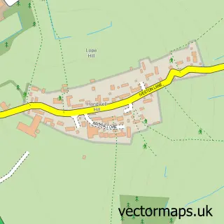
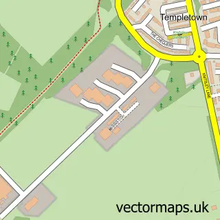
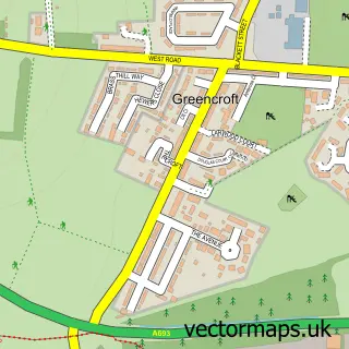
This Leadgate street map is a detailed vector street map covering a 750m x 750m area. Select a larger area to create and download your own vector street map of Leadgate.
The 750-metre map sample for Leadgate covers 367 mapped buildings and approximately 24.9 km of road detail, of which 44 named roads are named. The immediate area includes 1 school, 1 GP surgery, with 3 within 2 miles and 12 MOT stations within 2 miles. The wider area around Leadgate features 1 tourism point of interest and 3 food and drink venues. To create a larger or custom map of Leadgate, the map builder lets you define your own coverage area and download editable SVG, PDF and PNG files.
Create a larger editable map of Leadgate
Choose any area you need and generate a high-quality vector map instantly. Perfect for print, planning, design, business and personal use.

This Leadgate street map in Durham is available as downloadable SVG, PDF and PNG map files, or as a printed map for planning, business, display, education, local information and design work. You can also create a larger custom map area using the map selector.
What this Leadgate map sample shows
Leadgate lies within County Durham parish, part of Leadgate And Medomsley ward in the County Durham local authority area. The postcode geography for this area includes the DH postcode area, the DH8 postcode district and the DH8 6 postcode sector. Residents fall under the Nhs North East And North Cumbria Integrated Care Board for NHS services.
Local features near Leadgate
Within 2 milesAmenities and services in and around Leadgate.
Administrative and postcode information for Leadgate
Leadgate lies within County Durham parish, part of Leadgate And Medomsley ward in the County Durham local authority area. The postcode geography for this area includes the DH postcode area, the DH8 postcode district and the DH8 6 postcode sector. Residents fall under the Nhs North East And North Cumbria Integrated Care Board for NHS services.
Nearby street map samples around Leadgate

More street maps in Durham
750 metre map area coverage
Boundary, postcode and point of interest information for the 750m x 750m rectangle centred on this sample map.
Boundaries containing map centre
Constituency: Blaydon and Consett Co Const
District: County Durham
Icb: NHS North East and North Cumbria ICB
Police Force: durham
Postcode District: DH8
Postcode Sector: DH8 6
Nearby boundaries intersecting sample
Postcode Sector: DH8 7
Postcode coverage
POI category counts
Charity Organization: 4
Convenience Store: 4
Beauty Salon: 3
Automotive Parts And Accessories: 2
Building Supply Store: 2
Cafe: 2
Chinese Restaurant: 2
Dance School: 2
Doctor: 2
Elementary School: 2
Sample points of interest
- Gonka’s Tavern
- Durham Community Tennis Partnership
- Art-e-Factory
- Craft Connections Durham
- The Cooperative Food (BF) Leadgate, Leadgate
- Pigweed Motorcycle Parts
- The Landy Men
- Roxy Shop
- Barclays
- The Golden Lion - Leadgate
- Nuts Barbers
- Salon 19
Create a larger editable map of Leadgate
This sample shows only a 750 metre area. To create a larger map of Leadgate, use our map builder to choose your own coverage area, add titles and download editable SVG, PDF and PNG files.
Create a custom map of Leadgate