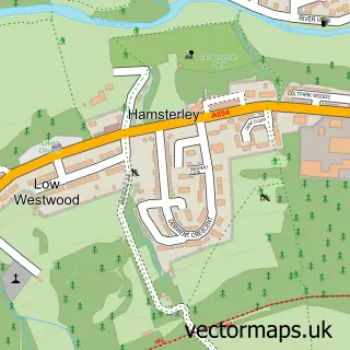
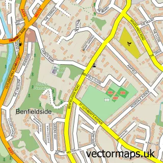
This Medomsley street map is a detailed vector street map covering a 750m x 750m area. Select a larger area to create and download your own vector street map of Medomsley.
The 750-metre map sample for Medomsley covers 178 mapped buildings and approximately 10.1 km of road detail, of which 10 named roads are named. The immediate area includes 1 school, 3 GP surgeries within 2 miles, 2 pubs and 5 MOT stations within 2 miles. The wider area around Medomsley features 2 food and drink venues. To create a larger or custom map of Medomsley, the map builder lets you define your own coverage area and download editable SVG, PDF and PNG files.
Create a larger editable map of Medomsley
Choose any area you need and generate a high-quality vector map instantly. Perfect for print, planning, design, business and personal use.

This Medomsley street map in Durham is available as downloadable SVG, PDF and PNG map files, or as a printed map for planning, business, display, education, local information and design work. You can also create a larger custom map area using the map selector.
What this Medomsley map sample shows
Medomsley lies within County Durham parish, part of Leadgate And Medomsley ward in the County Durham local authority area. The postcode geography for this area includes the DH postcode area, the DH8 postcode district and the DH8 6 postcode sector. Residents fall under the Nhs North East And North Cumbria Integrated Care Board for NHS services.
Local features near Medomsley
Within 2 milesAmenities and services in and around Medomsley.
Administrative and postcode information for Medomsley
Medomsley lies within County Durham parish, part of Leadgate And Medomsley ward in the County Durham local authority area. The postcode geography for this area includes the DH postcode area, the DH8 postcode district and the DH8 6 postcode sector. Residents fall under the Nhs North East And North Cumbria Integrated Care Board for NHS services.
Nearby street map samples around Medomsley

More street maps in Durham
750 metre map area coverage
Boundary, postcode and point of interest information for the 750m x 750m rectangle centred on this sample map.
Boundaries containing map centre
Constituency: Blaydon and Consett Co Const
District: County Durham
Icb: NHS North East and North Cumbria ICB
Police Force: durham
Postcode District: DH8
Postcode Sector: DH8 6
Nearby boundaries intersecting sample
No additional intersecting boundaries found.
Postcode coverage
POI category counts
Church Cathedral: 2
Pub: 2
Assisted Living Facility: 1
Beauty Salon: 1
Convenience Store: 1
Day Care Preschool: 1
Elementary School: 1
Pet Store: 1
Property Management: 1
Web Designer: 1
Sample points of interest
- The Manor House Care Home
- Hackers Bespoke Hairdressing at Home
- Medomsley Methodist Church
- St Mary Magdalene Church
- Jamuna Food and Wine
- Selby-at-BIR Nursery & Forest School
- Bishop Ian Ramsey Church of England Primary School
- Dirty Dogs Mobile Grooming
- PSS Property Maintenance
- The Miners Arms
- The Royal Oak
- Wide-Eyed Design
Create a larger editable map of Medomsley
This sample shows only a 750 metre area. To create a larger map of Medomsley, use our map builder to choose your own coverage area, add titles and download editable SVG, PDF and PNG files.
Create a custom map of Medomsley