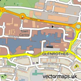
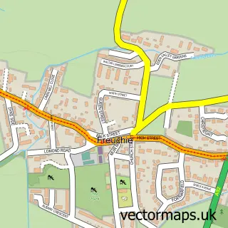
This Leslie street map is a detailed vector street map covering a 750m x 750m area. Select a larger area to create and download your own vector street map of Leslie.
The 750-metre map sample for Leslie covers 439 mapped buildings and approximately 17.9 km of road detail, of which 36 named roads are named. The immediate area includes 1 GP surgery, with 4 within 2 miles, 2 pubs and 2 MOT stations, with 7 within 2 miles. The wider area around Leslie features 2 tourism points of interest, 8 food and drink venues and 3 hotels. To create a larger or custom map of Leslie, the map builder lets you define your own coverage area and download editable SVG, PDF and PNG files.
Create a larger editable map of Leslie
Choose any area you need and generate a high-quality vector map instantly. Perfect for print, planning, design, business and personal use.

This Leslie street map in Fife is available as downloadable SVG, PDF and PNG map files, or as a printed map for planning, business, display, education, local information and design work. You can also create a larger custom map area using the map selector.
What this Leslie map sample shows
Leslie lies within Fife parish, part of Glenrothes North, Leslie And Markinch ward in the Fife local authority area. The postcode geography for this area includes the KY postcode area, the KY6 postcode district and the KY6 3 postcode sector. Residents fall under the Fife for NHS services.
Local features near Leslie
Within 2 milesAmenities and services in and around Leslie.
Administrative and postcode information for Leslie
Leslie lies within Fife parish, part of Glenrothes North, Leslie And Markinch ward in the Fife local authority area. The postcode geography for this area includes the KY postcode area, the KY6 postcode district and the KY6 3 postcode sector. Residents fall under the Fife for NHS services.
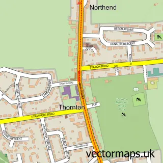
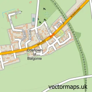
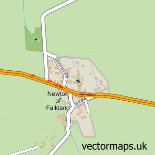
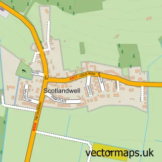
Nearby street map samples around Leslie

More street maps in Fife
750 metre map area coverage
Boundary, postcode and point of interest information for the 750m x 750m rectangle centred on this sample map.
Boundaries containing map centre
Constituency: Glenrothes and Mid Fife Co Const
District: Fife
Icb: Fife
Postcode District: KY6
Postcode Sector: KY6 3
Ward: Glenrothes North, Leslie and Markinch Ward
Nearby boundaries intersecting sample
Postcode Sector: KY6 1
Ward: Glenrothes West and Kinglassie Ward
Postcode coverage
POI category counts
Beauty Salon: 7
Hair Salon: 7
Convenience Store: 6
Cafe: 4
Dentist: 4
Pizza Restaurant: 4
Bakery: 3
Hotel: 3
Atms: 2
Barber: 2
Sample points of interest
- Leslie Christian Charity Shop
- Best One (Protected)(ERF), Leslie
- PayPoint
- Meadowbank Motors
- Bayne's the Family Bakers
- Leslie Tasty Bites
- S M Bayne & Co
- Leslie Baptist Church
- Har Barber Leslie
- Istanbul Barber Leslie
- Blossom Hair Beauty and Aesthetics
- Marios Barbers
Create a larger editable map of Leslie
This sample shows only a 750 metre area. To create a larger map of Leslie, use our map builder to choose your own coverage area, add titles and download editable SVG, PDF and PNG files.
Create a custom map of Leslie