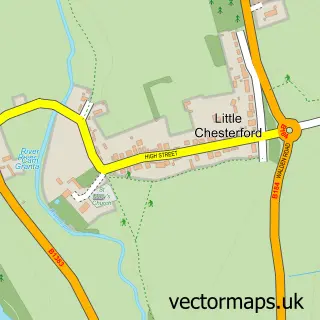
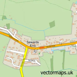
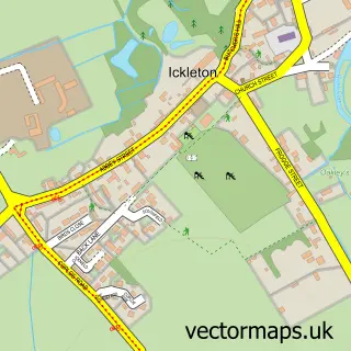
This Little Walden street map is a detailed vector street map covering a 750m x 750m area. Select a larger area to create and download your own vector street map of Little Walden.
The 750-metre map sample for Little Walden covers 57 mapped buildings and approximately 4.9 km of road detail, of which 2 named roads are named. The immediate area includes 1 GP surgery within 2 miles and 1 pub. The wider area around Little Walden features 1 food and drink venue. To create a larger or custom map of Little Walden, the map builder lets you define your own coverage area and download editable SVG, PDF and PNG files.
Create a larger editable map of Little Walden
Choose any area you need and generate a high-quality vector map instantly. Perfect for print, planning, design, business and personal use.

This Little Walden street map in Essex is available as downloadable SVG, PDF and PNG map files, or as a printed map for planning, business, display, education, local information and design work. You can also create a larger custom map area using the map selector.
What this Little Walden map sample shows
Little Walden lies within Saffron Walden Cp parish, part of Ashdon ward in the Uttlesford District local authority area. The postcode geography for this area includes the CB postcode area, the CB10 postcode district and the CB10 1 postcode sector. Residents fall under the Nhs Hertfordshire And West Essex Integrated Care Board for NHS services.
Local features near Little Walden
Within 2 milesAmenities and services in and around Little Walden.
Administrative and postcode information for Little Walden
The local authority covering Little Walden is Uttlesford District, within the county of Essex. The settlement lies within Ashdon ward and Saffron Walden Cp civil parish. The CB10 postcode district and CB10 1 postcode sector serve the immediate area. NHS provision in the area is delivered through Cambridge University Hospitals Nhs Foundation Trust.
Nearby street map samples around Little Walden

More street maps in Essex
750 metre map area coverage
Boundary, postcode and point of interest information for the 750m x 750m rectangle centred on this sample map.
Boundaries containing map centre
Constituency: North West Essex Co Const
County: Essex County
District: Uttlesford District
Icb: NHS Central East ICB
Parish: Saffron Walden CP
Police Force: essex
Postcode District: CB10
Postcode Sector: CB10 1
Ward: Ashdon Ward
Nearby boundaries intersecting sample
No additional intersecting boundaries found.
Postcode coverage
POI category counts
Home Cleaning: 2
Advertising Agency: 1
Anglican Church: 1
Art Gallery: 1
Assisted Living Facility: 1
Bridal Shop: 1
British Restaurant: 1
Building Supply Store: 1
Hvac Services: 1
Landscape Architect: 1
Sample points of interest
- Big Balls House
- Little Walden: St John
- W & G Prints
- Care at Home
- Treasured Moments Photography
- The Crown Little Walden
- 24 Seven Companies
- Cater Clean 24 Seven
- Trauma Clean 24 Seven
- Ambient Electrical Ltd.
- Mercer Tree Services
- The Dogbarber
Create a larger editable map of Little Walden
This sample shows only a 750 metre area. To create a larger map of Little Walden, use our map builder to choose your own coverage area, add titles and download editable SVG, PDF and PNG files.
Create a custom map of Little Walden