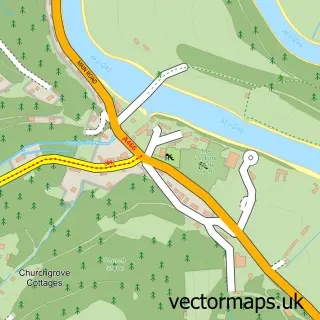
This Llandogo street map is a detailed vector street map covering a 750m x 750m area. Select a larger area to create and download your own vector street map of Llandogo.
The 750-metre map sample for Llandogo covers 183 mapped buildings and approximately 47.5 km of road detail, of which 4 named roads are named. The immediate area includes 1 school, 1 GP surgery within 2 miles, 1 pub and 1 MOT station within 2 miles. The wider area around Llandogo features 1 tourism point of interest, 1 food and drink venue and 1 hotel. To create a larger or custom map of Llandogo, the map builder lets you define your own coverage area and download editable SVG, PDF and PNG files.
Create a larger editable map of Llandogo
Choose any area you need and generate a high-quality vector map instantly. Perfect for print, planning, design, business and personal use.

This Llandogo street map in Gwent is available as downloadable SVG, PDF and PNG map files, or as a printed map for planning, business, display, education, local information and design work. You can also create a larger custom map area using the map selector.
What this Llandogo map sample shows
Llandogo lies within Wye Valley Community parish, part of Trellech United ward in the Sir Fynwy - Monmouthshire local authority area. The postcode geography for this area includes the NP postcode area, the NP25 postcode district and the NP25 4 postcode sector. Residents fall under the Aneurin Bevan University Health Board for NHS services.
Local features near Llandogo
Within 2 milesAmenities and services in and around Llandogo.
Administrative and postcode information for Llandogo
The local authority covering Llandogo is Sir Fynwy - Monmouthshire, within the county of Gwent. The settlement lies within Trellech United ward and Wye Valley Community civil parish. The NP25 postcode district and NP25 4 postcode sector serve the immediate area. NHS provision in the area is delivered through Aneurin Bevan University Health Board.
Nearby street map samples around Llandogo

More street maps in Gwent
750 metre map area coverage
Boundary, postcode and point of interest information for the 750m x 750m rectangle centred on this sample map.
Boundaries containing map centre
Constituency: Monmouthshire Co Const
District: Sir Fynwy - Monmouthshire
Icb: Aneurin Bevan University
Parish: Wye Valley Community
Police Force: gwent
Postcode District: NP25
Postcode Sector: NP25 4
Nearby boundaries intersecting sample
Constituency: Forest of Dean Co Const
County: Gloucestershire County
District: Forest of Dean District
Icb: NHS Gloucestershire ICB
Parish: St. Briavels CP
Police Force: gloucestershire
Postcode District: GL15
Postcode Sector: GL15 6
Ward: St. Briavels Ward
Postcode coverage
POI category counts
Elementary School: 2
Gym: 2
Art Gallery: 1
Business Management Services: 1
Church Cathedral: 1
Community Center: 1
Convenience Store: 1
Furniture Store: 1
Hotel: 1
Landscaping: 1
Sample points of interest
- Wye Valley Arts Centre
- Reckless Orchard
- St Oudoceus
- Llandogo Village Hall
- Londis
- Llandogo Primary School
- Llandogo Primary School
- Abbie Carpets
- And Exhale with Tracy
- Llandogo WI
- Bank Cottage
- Brooke Estate Management
Create a larger editable map of Llandogo
This sample shows only a 750 metre area. To create a larger map of Llandogo, use our map builder to choose your own coverage area, add titles and download editable SVG, PDF and PNG files.
Create a custom map of Llandogo