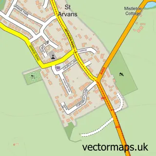
This Tintern street map is a detailed vector street map covering a 750m x 750m area. Select a larger area to create and download your own vector street map of Tintern.
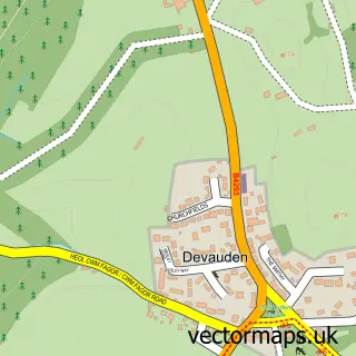
The 750-metre map sample for Tintern covers 89 mapped buildings and approximately 19.1 km of road detail, of which 1 named road are named. The immediate area includes 1 GP surgery and 3 pubs. The wider area around Tintern features 3 tourism points of interest, 7 food and drink venues and 5 hotels. To create a larger or custom map of Tintern, the map builder lets you define your own coverage area and download editable SVG, PDF and PNG files.
Create a larger editable map of Tintern
Choose any area you need and generate a high-quality vector map instantly. Perfect for print, planning, design, business and personal use.

This Tintern street map in Gwent is available as downloadable SVG, PDF and PNG map files, or as a printed map for planning, business, display, education, local information and design work. You can also create a larger custom map area using the map selector.
What this Tintern map sample shows
Tintern lies within Wye Valley Community parish, part of St. Arvans ward in the Sir Fynwy - Monmouthshire local authority area. The postcode geography for this area includes the NP postcode area, the NP16 postcode district and the NP16 6 postcode sector. Residents fall under the Aneurin Bevan University Health Board for NHS services.
Local features near Tintern
Within 2 milesAmenities and services in and around Tintern.
Administrative and postcode information for Tintern
Tintern lies within Wye Valley Community parish, part of St. Arvans ward in the Sir Fynwy - Monmouthshire local authority area. The postcode geography for this area includes the NP postcode area, the NP16 postcode district and the NP16 6 postcode sector. Residents fall under the Aneurin Bevan University Health Board for NHS services.
Nearby street map samples around Tintern


More street maps in Gwent
750 metre map area coverage
Boundary, postcode and point of interest information for the 750m x 750m rectangle centred on this sample map.
Boundaries containing map centre
Constituency: Monmouthshire Co Const
District: Sir Fynwy - Monmouthshire
Icb: Aneurin Bevan University
Parish: Wye Valley Community
Police Force: gwent
Postcode District: NP16
Postcode Sector: NP16 6
Nearby boundaries intersecting sample
Constituency: Forest of Dean Co Const
County: Gloucestershire County
District: Forest of Dean District
Parish: Hewelsfield and Brockweir CP, St. Arvans Community
Police Force: gloucestershire
Postcode Sector: NP16 7
Ward: St. Briavels Ward
Postcode coverage
POI category counts
Hotel: 5
Pub: 3
Restaurant: 3
Church Cathedral: 2
Naturopathic Holistic: 2
Post Office: 2
River: 2
Active Life: 1
Art Gallery: 1
Arts And Crafts: 1
Sample points of interest
- Ravensnest Trout Fishery
- The Boat House Gallery and Artisan Crafts
- Abbey Jewellery
- Codi International
- Stella Books
- Codi International Ltd
- Abbey Mill Tintern
- Ferry Farm Camping
- St Mary’s Church Tintern
- Tintetn Abbey
- Wye Dean Practice
- Wye Valley Crafts Association
Create a larger editable map of Tintern
This sample shows only a 750 metre area. To create a larger map of Tintern, use our map builder to choose your own coverage area, add titles and download editable SVG, PDF and PNG files.
Create a custom map of Tintern