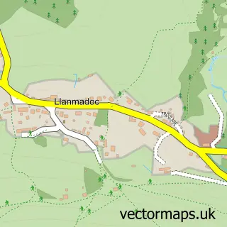
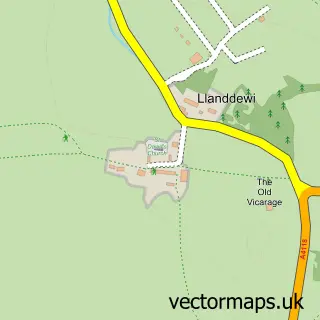
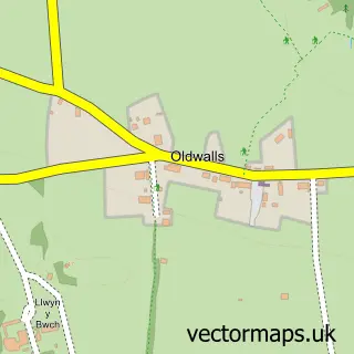
This Llangennith street map is a detailed vector street map covering a 750m x 750m area. Select a larger area to create and download your own vector street map of Llangennith.
The 750-metre map sample for Llangennith covers 145 mapped buildings and approximately 9.4 km of road detail, of which 6 named roads are named. The immediate area includes 1 pub. The wider area around Llangennith features 1 tourism point of interest, 1 food and drink venue and 1 campsite within 2 miles. To create a larger or custom map of Llangennith, the map builder lets you define your own coverage area and download editable SVG, PDF and PNG files.
Create a larger editable map of Llangennith
Choose any area you need and generate a high-quality vector map instantly. Perfect for print, planning, design, business and personal use.

This Llangennith street map in West Glamorgan is available as downloadable SVG, PDF and PNG map files, or as a printed map for planning, business, display, education, local information and design work. You can also create a larger custom map area using the map selector.
What this Llangennith map sample shows
Llangennith lies within Llangennith, Llanmadoc And Cheriton Community parish, part of Gower ward in the Abertawe - Swansea local authority area. The postcode geography for this area includes the SA postcode area, the SA3 postcode district and the SA3 1 postcode sector. Residents fall under the Swansea Bay University Local Health Board for NHS services.
Local features near Llangennith
Within 2 milesAmenities and services in and around Llangennith.
Administrative and postcode information for Llangennith
Llangennith lies within Llangennith, Llanmadoc And Cheriton Community parish, part of Gower ward in the Abertawe - Swansea local authority area. The postcode geography for this area includes the SA postcode area, the SA3 postcode district and the SA3 1 postcode sector. Residents fall under the Swansea Bay University Local Health Board for NHS services.
Nearby street map samples around Llangennith

More street maps in West Glamorgan
750 metre map area coverage
Boundary, postcode and point of interest information for the 750m x 750m rectangle centred on this sample map.
Boundaries containing map centre
Constituency: Gower Co Const
District: Abertawe - Swansea
Icb: Abertawe Bro Morgannwg University
Parish: Llangennith, Llanmadoc and Cheriton Community
Police Force: south wales
Postcode District: SA3
Postcode Sector: SA3 1
Nearby boundaries intersecting sample
No additional intersecting boundaries found.
Postcode coverage
POI category counts
Bed And Breakfast: 2
Surf Shop: 2
Advertising Agency: 1
Beach: 1
Business Management Services: 1
Campground: 1
Energy Equipment And Solution: 1
Holiday Rental Home: 1
Inn: 1
Printing Services: 1
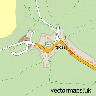
Sample points of interest
- N B Design
- Rhossili Hilltop
- Blas Gwyr
- Western House B&B
- Alun Mathias Associates
- Bank Farm
- WDS Green Energy
- Lower Mill
- Kings Head Inn
- Lighthouse Printing
- A & M Agriculture
- The King's Head
Create a larger editable map of Llangennith
This sample shows only a 750 metre area. To create a larger map of Llangennith, use our map builder to choose your own coverage area, add titles and download editable SVG, PDF and PNG files.
Create a custom map of Llangennith