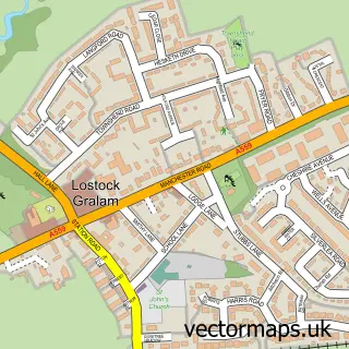
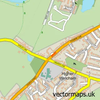
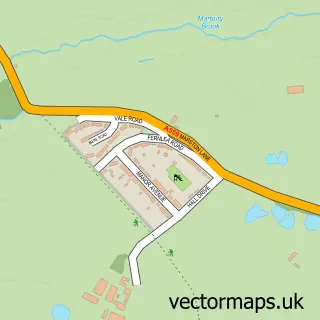
This Lostock Green street map is a detailed vector street map covering a 750m x 750m area. Select a larger area to create and download your own vector street map of Lostock Green.
The 750-metre map sample for Lostock Green covers 111 mapped buildings and approximately 8.2 km of road detail, of which 5 named roads are named. The immediate area includes 2 GP surgeries within 2 miles and 16 MOT stations within 2 miles. The wider area around Lostock Green features 2 tourism points of interest and 1 food and drink venue. To create a larger or custom map of Lostock Green, the map builder lets you define your own coverage area and download editable SVG, PDF and PNG files.
Create a larger editable map of Lostock Green
Choose any area you need and generate a high-quality vector map instantly. Perfect for print, planning, design, business and personal use.

This Lostock Green street map in Cheshire is available as downloadable SVG, PDF and PNG map files, or as a printed map for planning, business, display, education, local information and design work. You can also create a larger custom map area using the map selector.
What this Lostock Green map sample shows
Lostock Green lies within Lach Dennis And Lostock Green Cp parish, part of Shakerley ward in the Cheshire West And Chester (B) local authority area. The postcode geography for this area includes the CW postcode area, the CW9 postcode district and the CW9 7 postcode sector. Residents fall under the Nhs Cheshire And Merseyside Integrated Care Board for NHS services.
Local features near Lostock Green
Within 2 milesAmenities and services in and around Lostock Green.
Administrative and postcode information for Lostock Green
Lostock Green lies within Lach Dennis And Lostock Green Cp parish, part of Shakerley ward in the Cheshire West And Chester (B) local authority area. The postcode geography for this area includes the CW postcode area, the CW9 postcode district and the CW9 7 postcode sector. Residents fall under the Nhs Cheshire And Merseyside Integrated Care Board for NHS services.
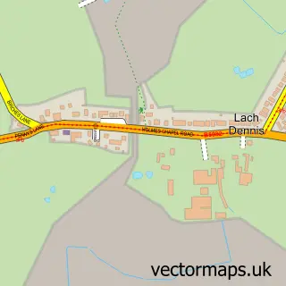
Nearby street map samples around Lostock Green

More street maps in Cheshire
750 metre map area coverage
Boundary, postcode and point of interest information for the 750m x 750m rectangle centred on this sample map.
Boundaries containing map centre
Constituency: Tatton Co Const
District: Cheshire West and Chester (B)
Icb: NHS Cheshire and Merseyside ICB
Parish: Lach Dennis and Lostock Green CP
Police Force: cheshire
Postcode District: CW9
Postcode Sector: CW9 7
Ward: Shakerley Ward
Nearby boundaries intersecting sample
Constituency: Mid Cheshire Co Const
Parish: Rudheath CP
Ward: Rudheath Ward
Postcode coverage
POI category counts
Funeral Services And Cemeteries: 2
Advertising Agency: 1
Cafe: 1
Driving School: 1
Farm: 1
Landmark And Historical Building: 1
Park: 1
Preschool: 1
Sign Making: 1
Tree Services: 1
Sample points of interest
- Simon Roberts
- Country Fayre Cafe
- Donald's School of Motoring
- Park Farm Arable & Livery
- George Bell Funeral Service
- Rosemarie Teece Celebrant
- Lostock Green
- Lostock Green Playground
- Bradshaw Brook Pre School
- Rj Signs & Graphics
- OJT Tree Services
Create a larger editable map of Lostock Green
This sample shows only a 750 metre area. To create a larger map of Lostock Green, use our map builder to choose your own coverage area, add titles and download editable SVG, PDF and PNG files.
Create a custom map of Lostock Green