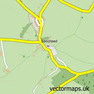
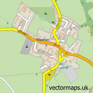
This Lower Drift street map is a detailed vector street map covering a 750m x 750m area. Select a larger area to create and download your own vector street map of Lower Drift.
The 750-metre map sample for Lower Drift covers 49 mapped buildings and approximately 7.6 km of road detail, of which 2 named roads are named. The immediate area includes 3 MOT stations within 2 miles. The wider area around Lower Drift features 1 tourism point of interest and 2 campsites within 2 miles. To create a larger or custom map of Lower Drift, the map builder lets you define your own coverage area and download editable SVG, PDF and PNG files.
Create a larger editable map of Lower Drift
Choose any area you need and generate a high-quality vector map instantly. Perfect for print, planning, design, business and personal use.

This Lower Drift street map in Cornwall is available as downloadable SVG, PDF and PNG map files, or as a printed map for planning, business, display, education, local information and design work. You can also create a larger custom map area using the map selector.
What this Lower Drift map sample shows
Lower Drift lies within Sancreed Cp parish, part of St Buryan ward in the Cornwall local authority area. The postcode geography for this area includes the TR postcode area, the TR19 postcode district and the TR19 6 postcode sector. Residents fall under the Nhs Cornwall And The Isles Of Scilly Integrated Care Board for NHS services.
Local features near Lower Drift
Within 2 milesAmenities and services in and around Lower Drift.
Administrative and postcode information for Lower Drift
Lower Drift lies within Sancreed Cp parish, part of St Buryan ward in the Cornwall local authority area. The postcode geography for this area includes the TR postcode area, the TR19 postcode district and the TR19 6 postcode sector. Residents fall under the Nhs Cornwall And The Isles Of Scilly Integrated Care Board for NHS services.
Nearby street map samples around Lower Drift

More street maps in Cornwall
750 metre map area coverage
Boundary, postcode and point of interest information for the 750m x 750m rectangle centred on this sample map.
Boundaries containing map centre
Constituency: St. Ives Co Const
District: Cornwall
Icb: NHS Cornwall and the Isles of Scilly ICB
Parish: Sancreed CP
Police Force: devon and cornwall
Postcode District: TR19
Postcode Sector: TR19 6
Nearby boundaries intersecting sample
Parish: Madron CP, St. Buryan, Lamorna and Paul CP
Postcode District: TR20
Postcode Sector: TR20 8
Postcode coverage
POI category counts
Audio Visual Equipment Store: 1
Automotive Repair: 1
Boat Service And Repair: 1
Cleaning Services: 1
Cottage: 1
Fishing Club: 1
Hvac Services: 1
Landmark And Historical Building: 1
Travel Services: 1
Waxing: 1
Sample points of interest
- Acoustic Streams
- Buryas Bridge Garage
- Simpson Outboards
- Kernow Cleaning Services
- The Old Workshop - Drift
- Drift Fly Fishing Club
- Steven Buckland Heating
- Drift, Cornwall
- Travel Counsellors - Vanessa de Vere
- Wax Benefit Drift
Create a larger editable map of Lower Drift
This sample shows only a 750 metre area. To create a larger map of Lower Drift, use our map builder to choose your own coverage area, add titles and download editable SVG, PDF and PNG files.
Create a custom map of Lower Drift