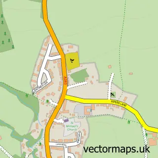
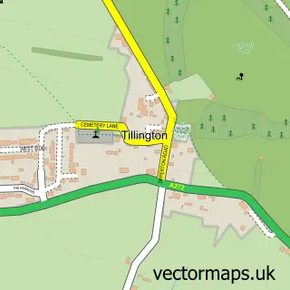
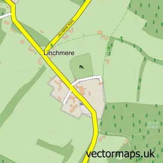
This Lurgashall street map is a detailed vector street map covering a 750m x 750m area. Select a larger area to create and download your own vector street map of Lurgashall.
The 750-metre map sample for Lurgashall covers 84 mapped buildings and approximately 10.3 km of road detail, of which 1 named road are named. The immediate area includes 1 pub and 2 MOT stations within 2 miles. The wider area around Lurgashall features 1 food and drink venue. To create a larger or custom map of Lurgashall, the map builder lets you define your own coverage area and download editable SVG, PDF and PNG files.
Create a larger editable map of Lurgashall
Choose any area you need and generate a high-quality vector map instantly. Perfect for print, planning, design, business and personal use.

This Lurgashall street map in West Sussex is available as downloadable SVG, PDF and PNG map files, or as a printed map for planning, business, display, education, local information and design work. You can also create a larger custom map area using the map selector.
What this Lurgashall map sample shows
Lurgashall lies within Lurgashall Cp parish, part of Fernhurst ward in the Chichester District local authority area. The postcode geography for this area includes the GU postcode area, the GU28 postcode district and the GU28 9 postcode sector. Residents fall under the Nhs Surrey Heartlands Integrated Care Board for NHS services.
Local features near Lurgashall
Within 2 milesAmenities and services in and around Lurgashall.
Administrative and postcode information for Lurgashall
The local authority covering Lurgashall is Chichester District, within the county of West Sussex. The settlement lies within Fernhurst ward and Lurgashall Cp civil parish. The GU28 postcode district and GU28 9 postcode sector serve the immediate area. NHS provision in the area is delivered through Royal Surrey County Hospital Nhs Foundation Trust.
Nearby street map samples around Lurgashall

More street maps in West Sussex
750 metre map area coverage
Boundary, postcode and point of interest information for the 750m x 750m rectangle centred on this sample map.
Boundaries containing map centre
Constituency: Arundel and South Downs Co Const
County: West Sussex County
District: Chichester District
Icb: NHS Surrey and Sussex ICB
Parish: Lurgashall CP
Police Force: sussex
Postcode District: GU28
Postcode Sector: GU28 9
Ward: Fernhurst Ward
Nearby boundaries intersecting sample
No additional intersecting boundaries found.
Postcode coverage
POI category counts
Landscaping: 2
Anglican Church: 1
Arts And Entertainment: 1
Bus Station: 1
Business Manufacturing And Supply: 1
Church Cathedral: 1
Gastropub: 1
Marketing Agency: 1
Pet Breeder: 1
Post Office: 1
Sample points of interest
- St Laurence
- Little Lightning
- Post Office
- CWD Hydraulics
- Saint Laurence
- The Noah's Ark Inn
- Waratah Gardens Ltd
- Yard Garden Style
- Coolship Marketing
- DrakesGreen Gun Dogs
- Lurgashall Village Shop
- Jacquie Lawson ecards
Create a larger editable map of Lurgashall
This sample shows only a 750 metre area. To create a larger map of Lurgashall, use our map builder to choose your own coverage area, add titles and download editable SVG, PDF and PNG files.
Create a custom map of Lurgashall