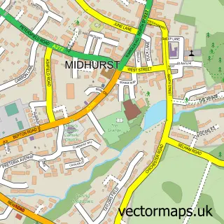
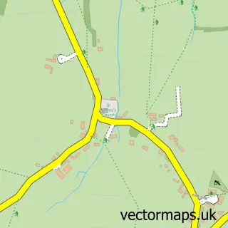
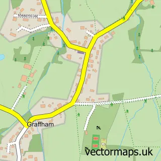
This Easebourne street map is a detailed vector street map covering a 750m x 750m area. Select a larger area to create and download your own vector street map of Easebourne.
The 750-metre map sample for Easebourne covers 113 mapped buildings and approximately 6.1 km of road detail, of which 7 named roads are named. The immediate area includes 1 GP surgery within 2 miles, 1 pub and 3 MOT stations within 2 miles. The wider area around Easebourne features 1 tourism point of interest and 3 food and drink venues. To create a larger or custom map of Easebourne, the map builder lets you define your own coverage area and download editable SVG, PDF and PNG files.
Create a larger editable map of Easebourne
Choose any area you need and generate a high-quality vector map instantly. Perfect for print, planning, design, business and personal use.

This Easebourne street map in West Sussex is available as downloadable SVG, PDF and PNG map files, or as a printed map for planning, business, display, education, local information and design work. You can also create a larger custom map area using the map selector.
What this Easebourne map sample shows
Easebourne lies within Easebourne Cp parish, part of Easebourne ward in the Chichester District local authority area. The postcode geography for this area includes the GU postcode area, the GU29 postcode district and the GU29 9 postcode sector. Residents fall under the Nhs Sussex Integrated Care Board for NHS services.
Local features near Easebourne
Within 2 milesAmenities and services in and around Easebourne.
Administrative and postcode information for Easebourne
The local authority covering Easebourne is Chichester District, within the county of West Sussex. The settlement lies within Easebourne ward and Easebourne Cp civil parish. The GU29 postcode district and GU29 9 postcode sector serve the immediate area. NHS provision in the area is delivered through University Hospitals Sussex Nhs Foundation Trust.
Nearby street map samples around Easebourne

More street maps in West Sussex
750 metre map area coverage
Boundary, postcode and point of interest information for the 750m x 750m rectangle centred on this sample map.
Boundaries containing map centre
Constituency: Arundel and South Downs Co Const
County: West Sussex County
District: Chichester District
Icb: NHS Surrey and Sussex ICB
Parish: Easebourne CP
Police Force: sussex
Postcode District: GU29
Postcode Sector: GU29 0
Ward: Easebourne Ward
Nearby boundaries intersecting sample
Postcode Sector: GU29 9
Postcode coverage
POI category counts
Cafe: 2
Scout Hall: 2
Acupuncture: 1
Anglican Church: 1
Arts And Entertainment: 1
Bar: 1
Church Cathedral: 1
Clothing Store: 1
Flowers And Gifts Shop: 1
Golf Course: 1
Sample points of interest
- Paula Macklin Creasy Acupuncture
- St Mary
- Cowdray Lawns Polo Grounds
- Smith, M D
- Cowdray Farm Shop & Cafe
- Cowdray Park, West Sussex
- St Mary's Church
- Hudson and Colt
- Ramshackle Flowers
- Cowdray Park Golf Club
- Harry Smith Golf Coaching
- Easebourne Village Stores
Create a larger editable map of Easebourne
This sample shows only a 750 metre area. To create a larger map of Easebourne, use our map builder to choose your own coverage area, add titles and download editable SVG, PDF and PNG files.
Create a custom map of Easebourne