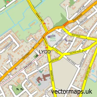
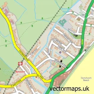
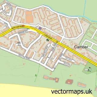
This Lydd-on-Sea street map is a detailed vector street map covering a 750m x 750m area. Select a larger area to create and download your own vector street map of Lydd-on-Sea.
The 750-metre map sample for Lydd-on-Sea covers 74 mapped buildings and approximately 4.9 km of road detail, of which 4 named roads are named. The immediate area includes 2 pubs. The wider area around Lydd-on-Sea features 2 food and drink venues and 1 hotel. To create a larger or custom map of Lydd-on-Sea, the map builder lets you define your own coverage area and download editable SVG, PDF and PNG files.
Create a larger editable map of Lydd-on-Sea
Choose any area you need and generate a high-quality vector map instantly. Perfect for print, planning, design, business and personal use.

This Lydd-on-Sea street map in Kent is available as downloadable SVG, PDF and PNG map files, or as a printed map for planning, business, display, education, local information and design work. You can also create a larger custom map area using the map selector.
What this Lydd-on-Sea map sample shows
Lydd-on-Sea lies within Lydd Cp parish, part of Walland & Denge Marsh ward in the Folkestone And Hythe District local authority area. The postcode geography for this area includes the TN postcode area, the TN29 postcode district and the TN29 9 postcode sector. Residents fall under the Nhs Kent And Medway Integrated Care Board for NHS services.
Local features near Lydd-on-Sea
Within 2 milesAmenities and services in and around Lydd-on-Sea.
Administrative and postcode information for Lydd-on-Sea
Lydd-on-Sea lies within Lydd Cp parish, part of Walland & Denge Marsh ward in the Folkestone And Hythe District local authority area. The postcode geography for this area includes the TN postcode area, the TN29 postcode district and the TN29 9 postcode sector. Residents fall under the Nhs Kent And Medway Integrated Care Board for NHS services.
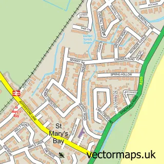
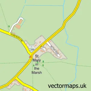
Nearby street map samples around Lydd-on-Sea

More street maps in Kent
750 metre map area coverage
Boundary, postcode and point of interest information for the 750m x 750m rectangle centred on this sample map.
Boundaries containing map centre
Constituency: Folkestone and Hythe Co Const
County: Kent County
District: Folkestone and Hythe District
Icb: NHS Kent and Medway ICB
Parish: Lydd CP
Police Force: kent
Postcode District: TN29
Postcode Sector: TN29 9
Ward: Walland & Denge Marsh Ward
Nearby boundaries intersecting sample
No additional intersecting boundaries found.
Postcode coverage
POI category counts
Pub: 2
British Restaurant: 1
Community Services Non Profits: 1
Fishing Club: 1
Fishmonger: 1
Holiday Rental Home: 1
Hotel: 1
Nature Reserve: 1
Seafood Market: 1
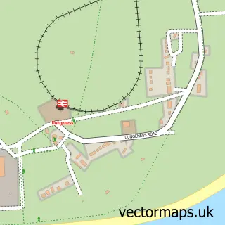
Sample points of interest
- Dungerness Pilot Inn
- RNLI Dungeness Lifeboat Station
- Dungeness Charter Fishing
- M & M Richardson
- Seaview Cottage Dungeness
- Fulmar
- Dungeness National Nature Reserve
- The Pilot Inn
- The Pilot Inn
- Dungeness Fish
Create a larger editable map of Lydd-on-Sea
This sample shows only a 750 metre area. To create a larger map of Lydd-on-Sea, use our map builder to choose your own coverage area, add titles and download editable SVG, PDF and PNG files.
Create a custom map of Lydd-on-Sea