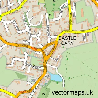
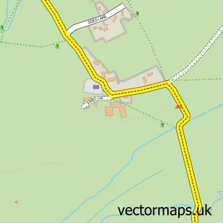
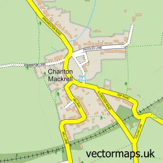
This Lydford-on-Fosse street map is a detailed vector street map covering a 750m x 750m area. Select a larger area to create and download your own vector street map of Lydford-on-Fosse.
The 750-metre map sample for Lydford-on-Fosse covers 63 mapped buildings and approximately 6.5 km of road detail, of which 2 named roads are named. The immediate area includes 2 pubs. The wider area around Lydford-on-Fosse features 3 food and drink venues and 1 campsite within 2 miles. To create a larger or custom map of Lydford-on-Fosse, the map builder lets you define your own coverage area and download editable SVG, PDF and PNG files.
Create a larger editable map of Lydford-on-Fosse
Choose any area you need and generate a high-quality vector map instantly. Perfect for print, planning, design, business and personal use.

This Lydford-on-Fosse street map in Somerset is available as downloadable SVG, PDF and PNG map files, or as a printed map for planning, business, display, education, local information and design work. You can also create a larger custom map area using the map selector.
What this Lydford-on-Fosse map sample shows
Lydford-on-Fosse lies within Lydford-On-Fosse Cp parish, part of Butleigh And Baltonsborough ward in the Somerset local authority area. The postcode geography for this area includes the TA postcode area, the TA11 postcode district and the TA11 7 postcode sector. Residents fall under the Nhs Somerset Integrated Care Board for NHS services.
Local features near Lydford-on-Fosse
Within 2 milesAmenities and services in and around Lydford-on-Fosse.
Administrative and postcode information for Lydford-on-Fosse
The local authority covering Lydford-on-Fosse is Somerset, within the county of Somerset. The settlement lies within Butleigh And Baltonsborough ward and Lydford-On-Fosse Cp civil parish. The TA11 postcode district and TA11 7 postcode sector serve the immediate area. NHS provision in the area is delivered through Yeovil District Hospital Nhs Foundation Trust.
Nearby street map samples around Lydford-on-Fosse

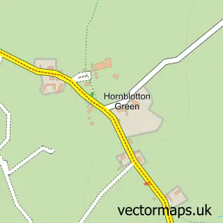
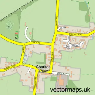
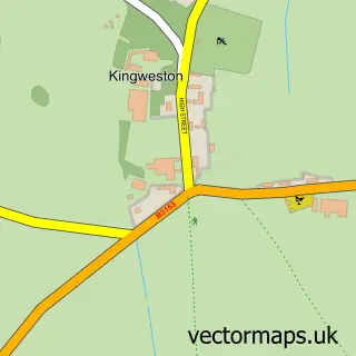
More street maps in Somerset
750 metre map area coverage
Boundary, postcode and point of interest information for the 750m x 750m rectangle centred on this sample map.
Boundaries containing map centre
Constituency: Glastonbury and Somerton Co Const
District: Somerset
Icb: NHS Somerset ICB
Parish: Lydford-on-Fosse CP
Police Force: avon and somerset
Postcode District: TA11
Postcode Sector: TA11 7
Nearby boundaries intersecting sample
No additional intersecting boundaries found.
Postcode coverage
POI category counts
Gas Station: 3
Convenience Store: 2
Pub: 2
Recreational Vehicle Dealer: 2
Arts And Entertainment: 1
Car Dealer: 1
Coffee Shop: 1
Package Locker: 1
Post Office: 1
Rental Kiosks: 1
Sample points of interest
- Lydford on Fosse
- Somerset Autos Ltd
- Costa Express
- Budgens Lydford
- SPAR
- Esso Lydford Service Station
- Lydford Services
- Shell
- Amazon Locker - robb
- Lydford Post Office
- Cross Keys Inn
- The Cross Keys Inn
Create a larger editable map of Lydford-on-Fosse
This sample shows only a 750 metre area. To create a larger map of Lydford-on-Fosse, use our map builder to choose your own coverage area, add titles and download editable SVG, PDF and PNG files.
Create a custom map of Lydford-on-Fosse