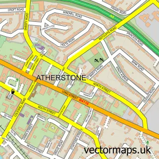
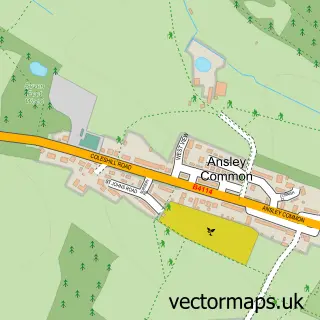
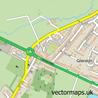
This Mancetter street map is a detailed vector street map covering a 750m x 750m area. Select a larger area to create and download your own vector street map of Mancetter.
The 750-metre map sample for Mancetter covers 412 mapped buildings and approximately 40.4 km of road detail, of which 32 named roads are named. The immediate area includes 1 school, 2 GP surgeries within 2 miles, 1 pub and 5 MOT stations within 2 miles. The wider area around Mancetter features 1 tourism point of interest, 3 food and drink venues and 1 campsite within 2 miles. To create a larger or custom map of Mancetter, the map builder lets you define your own coverage area and download editable SVG, PDF and PNG files.
Create a larger editable map of Mancetter
Choose any area you need and generate a high-quality vector map instantly. Perfect for print, planning, design, business and personal use.

This Mancetter street map in Warwickshire is available as downloadable SVG, PDF and PNG map files, or as a printed map for planning, business, display, education, local information and design work. You can also create a larger custom map area using the map selector.
What this Mancetter map sample shows
Mancetter lies within Mancetter Cp parish, part of Atherstone South And Mancetter ward in the North Warwickshire District (B) local authority area. The postcode geography for this area includes the CV postcode area, the CV9 postcode district and the CV9 1 postcode sector. Residents fall under the Nhs Coventry And Warwickshire Integrated Care Board for NHS services.
Local features near Mancetter
Within 2 milesAmenities and services in and around Mancetter.
Administrative and postcode information for Mancetter
Mancetter lies within Mancetter Cp parish, part of Atherstone South And Mancetter ward in the North Warwickshire District (B) local authority area. The postcode geography for this area includes the CV postcode area, the CV9 postcode district and the CV9 1 postcode sector. Residents fall under the Nhs Coventry And Warwickshire Integrated Care Board for NHS services.
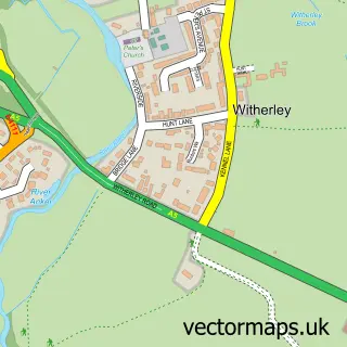
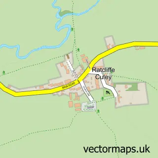
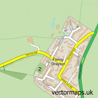
Nearby street map samples around Mancetter

More street maps in Warwickshire
750 metre map area coverage
Boundary, postcode and point of interest information for the 750m x 750m rectangle centred on this sample map.
Boundaries containing map centre
Constituency: North Warwickshire and Bedworth Co Const
County: Warwickshire County
District: North Warwickshire District (B)
Icb: NHS Coventry and Warwickshire ICB
Parish: Mancetter CP
Police Force: warwickshire
Postcode District: CV9
Postcode Sector: CV9 1
Ward: Atherstone South and Mancetter Ward
Nearby boundaries intersecting sample
Parish: Atherstone CP
Postcode Sector: CV9 2
Ward: Atherstone North Ward
Postcode coverage
POI category counts
Professional Services: 3
Convenience Store: 2
Hair Salon: 2
Anglican Church: 1
Assisted Living Facility: 1
Automotive Repair: 1
Cafe: 1
Church Cathedral: 1
Community Center: 1
Currency Exchange: 1
Sample points of interest
- Mancetter - St. Peter
- Gramer House
- Stateside Autoparts
- The Copper Kettle - Atherstone
- St Peter's Church, Mancetter
- Mancetter Memorial Hall
- Premier
- Premier Mancetter Stores
- Post Office Travel Money
- EJM Electrical Services Ltd
- St Benedict's Catholic Primary School
- Coiffeur
Create a larger editable map of Mancetter
This sample shows only a 750 metre area. To create a larger map of Mancetter, use our map builder to choose your own coverage area, add titles and download editable SVG, PDF and PNG files.
Create a custom map of Mancetter