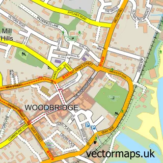
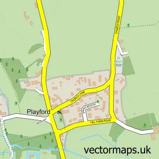
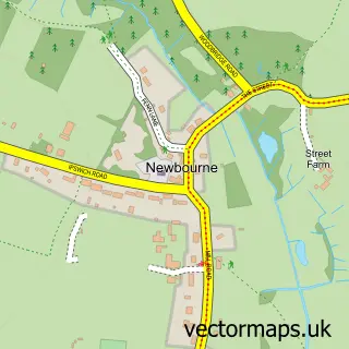
This Martlesham street map is a detailed vector street map covering a 750m x 750m area. Select a larger area to create and download your own vector street map of Martlesham.
The 750-metre map sample for Martlesham covers 310 mapped buildings and approximately 9.5 km of road detail, of which 16 named roads are named. The immediate area includes 3 GP surgeries within 2 miles, 2 pubs and 7 MOT stations within 2 miles. The wider area around Martlesham features 2 food and drink venues and 1 campsite within 2 miles. To create a larger or custom map of Martlesham, the map builder lets you define your own coverage area and download editable SVG, PDF and PNG files.
Create a larger editable map of Martlesham
Choose any area you need and generate a high-quality vector map instantly. Perfect for print, planning, design, business and personal use.

This Martlesham street map in Suffolk is available as downloadable SVG, PDF and PNG map files, or as a printed map for planning, business, display, education, local information and design work. You can also create a larger custom map area using the map selector.
What this Martlesham map sample shows
Martlesham lies within Martlesham Cp parish, part of Martlesham & Purdis Farm ward in the East Suffolk District local authority area. The postcode geography for this area includes the IP postcode area, the IP12 postcode district and the IP12 4 postcode sector. Residents fall under the Nhs Suffolk And North East Essex Integrated Care Board for NHS services.
Local features near Martlesham
Within 2 milesAmenities and services in and around Martlesham.
Administrative and postcode information for Martlesham
Martlesham lies within Martlesham Cp parish, part of Martlesham & Purdis Farm ward in the East Suffolk District local authority area. The postcode geography for this area includes the IP postcode area, the IP12 postcode district and the IP12 4 postcode sector. Residents fall under the Nhs Suffolk And North East Essex Integrated Care Board for NHS services.
Nearby street map samples around Martlesham

More street maps in Suffolk
750 metre map area coverage
Boundary, postcode and point of interest information for the 750m x 750m rectangle centred on this sample map.
Boundaries containing map centre
Constituency: Suffolk Coastal Co Const
County: Suffolk County
District: East Suffolk District
Icb: NHS Essex ICB
Parish: Martlesham CP
Police Force: suffolk
Postcode District: IP12
Postcode Sector: IP12 4
Ward: Martlesham & Purdis Farm Ward
Nearby boundaries intersecting sample
No additional intersecting boundaries found.
Postcode coverage
POI category counts
Carpenter: 2
Pub: 2
Advertising Agency: 1
Antique Store: 1
Aromatherapy: 1
Automotive Dealer: 1
Beauty Salon: 1
Building Supply Store: 1
Electrician: 1
Energy Equipment And Solution: 1
Sample points of interest
- Hot Off the Press
- Martlesham Antiques
- Aromatic Answers
- D C M Van Sales
- Sam at Dynamic Hair Salon
- Kesgrave Aggregates
- Crafted Carpentry and Construction
- I T Carpentry
- A A Electrical (East Anglia) Ltd.
- Sunlite Group
- Dan's Meadow
- Delta Bookkeeping Ltd
Create a larger editable map of Martlesham
This sample shows only a 750 metre area. To create a larger map of Martlesham, use our map builder to choose your own coverage area, add titles and download editable SVG, PDF and PNG files.
Create a custom map of Martlesham