Vector Maps logo
Home Why it works Popular maps Districts Samples Customizer Create Your Map
VectorMaps.uk
Home Popular maps Districts Samples Customizer Create Your Map Privacy Disclaimer
Home / UK Maps / Perth and Kinross / Milnathort Map

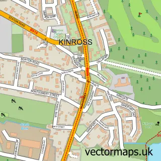
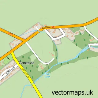
This Milnathort street map is a detailed vector street map covering a 750m x 750m area. Select a larger area to create and download your own vector street map of Milnathort.

Milnathort is a village in Perth And Kinross, in the Mid Scotland And Fife of Scotland. Historically, the area formed part of Kinross-Shire. The settlement falls within the Ochil And South Perthshire parliamentary constituency. It is served by the KY13 po

The 750-metre map sample for Milnathort covers 385 mapped buildings and approximately 13.3 km of road detail, of which 27 named roads are named. The immediate area includes 2 GP surgeries within 2 miles, 1 pub and 1 MOT station, with 4 within 2 miles. The wider area around Milnathort features 1 tourism point of interest, 3 food and drink venues and 2 hotels. To create a larger or custom map of Milnathort, the map builder lets you define your own coverage area and download editable SVG, PDF and PNG files.

385Buildings
13.27 kmRoads
27Named roads
0Residents within 2 miles
Create your own

Create a larger editable map of Milnathort

Choose any area you need and generate a high-quality vector map instantly. Perfect for print, planning, design, business and personal use.

Choose any location
Editable SVG files
Any size up to A0
PDF, PNG & more
Instant download
High quality guaranteed
Create My Custom Map
Secure, private & no credit card required
Milnathort Vector Street Map
750m Sample
Milnathort vector street map sample showing roads, buildings and local features in a 750 metre preview area
Buy Milnathort Map Print from £12.95 Buy Milnathort Digital Map from £6

This Milnathort street map in Perth and Kinross is available as downloadable SVG, PDF and PNG map files, or as a printed map for planning, business, display, education, local information and design work. You can also create a larger custom map area using the map selector.

What this Milnathort map sample shows

Milnathort lies within Perth And Kinross parish, part of Kinross-Shire ward in the Perth And Kinross local authority area. The postcode geography for this area includes the KY postcode area, the KY13 postcode district and the KY13 9 postcode sector. Residents fall under the Tayside for NHS services.

Local features near Milnathort

Within 2 miles

Amenities and services in and around Milnathort.

1 Campsites within 2 miles
2 GP surgeries within 2 miles
1 MOT stations 4 within 2 miles
1 Tourism & leisure
3 Food & drink
1 Pubs
2 Hotels
2 Vehicle services

Counts are approximate and based on publicly available data.

Administrative and postcode information for Milnathort

Milnathort lies within Perth And Kinross parish, part of Kinross-Shire ward in the Perth And Kinross local authority area. The postcode geography for this area includes the KY postcode area, the KY13 postcode district and the KY13 9 postcode sector. Residents fall under the Tayside for NHS services.

Parish PERTH AND KINROSS
Ward Kinross-shire
District / local authority Perth and Kinross
County Perth and Kinross
Historic county Kinross-shire
Postcode district KY13
Postcode sector KY13 9
Parliamentary constituency Ochil and South Perthshire
Region Mid Scotland and Fife
Country Scotland

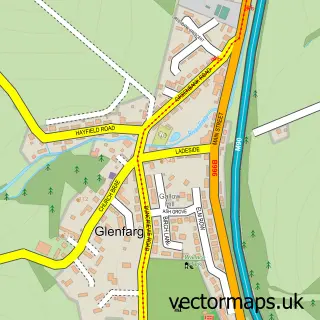
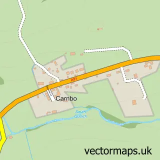
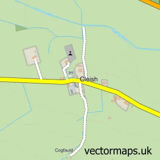
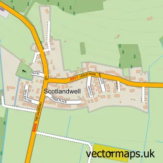
Nearby street map samples around Milnathort

Street map sample of Kinross, Perth and Kinross Kinross Town - Perth and Kinross - 1.6 miles Street map sample of Dunfermline, Fife Dunfermline City - Fife - 10.9 miles Street map sample of Balado, Perth and Kinross Balado Village - Perth and Kinross - 2.1 miles Street map sample of Duncrievie, Perth and Kinross Duncrievie Village - Perth and Kinross - 3.0 miles Street map sample of Kinnesswood, Perth and Kinross Kinnesswood Village - Perth and Kinross - 3.6 miles Street map sample of Glenfarg, Perth and Kinross Glenfarg Village - Perth and Kinross - 3.7 miles Street map sample of Carnbo, Perth and Kinross Carnbo Village - Perth and Kinross - 4.2 miles Street map sample of Cleish, Perth and Kinross Cleish Village - Perth and Kinross - 4.4 miles Street map sample of Scotlandwell, Perth and Kinross Scotlandwell Village - Perth and Kinross - 4.5 miles Street map sample of Gateside, Fife Gateside Village - Fife - 4.8 miles

More street maps in Perth and Kinross

Street map sample of Kinross, Perth and Kinross Kinross Town - 1.6 miles Street map sample of Balado, Perth and Kinross Balado Village - 2.1 miles Street map sample of Duncrievie, Perth and Kinross Duncrievie Village - 3.0 miles Street map sample of Kinnesswood, Perth and Kinross Kinnesswood Village - 3.6 miles Street map sample of Glenfarg, Perth and Kinross Glenfarg Village - 3.7 miles

750 metre map area coverage

Boundary, postcode and point of interest information for the 750m x 750m rectangle centred on this sample map.

Boundaries containing map centre

Constituency: Perth and Kinross-shire Co Const

District: Perth and Kinross

Icb: Tayside

Postcode District: KY13

Postcode Sector: KY13 9

Ward: Kinross-shire Ward

Nearby boundaries intersecting sample

Postcode Sector: KY13 0

Postcode coverage

KY13 KY13 9 KY13 0

POI category counts

Shipping Center: 3

Automotive Repair: 2

Cleaning Services: 2

Coffee Shop: 2

Community Services Non Profits: 2

Convenience Store: 2

Golf Course: 2

Hotel: 2

Martial Arts Club: 2

Physical Therapy: 2

Sample points of interest

  • Drysdale Trailers Agricultural Cooperatives
  • Alexander Harley Seeds - Milnathort Agricultural Service
  • Giacopazzi's/Nisa Local, Milnathort Atms
  • A J Spence Automotive Repair
  • Stewart & Smart Automotive Repair
  • RBS Bank Credit Union
  • OYO Thistle Hotel Bed And Breakfast
  • Perth & Kinross Community Transport Group Charity Organization
  • Milnathort Chinese Takeaway Chinese Restaurant
  • Milnathort Filmhouse Community Cinema Cinema
  • Servicemaster Cleaning Services
  • Spotless Oven Services Cleaning Services

Create a larger editable map of Milnathort

This sample shows only a 750 metre area. To create a larger map of Milnathort, use our map builder to choose your own coverage area, add titles and download editable SVG, PDF and PNG files.

Create a custom map of Milnathort

Phone 01751 473136 | Copyright Vectormaps.uk 2026

Samples Customizer Privacy Disclaimer
Milnathort Vector Street Map
Milnathort enlarged street map sample showing a 750 metre preview area