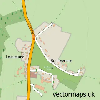
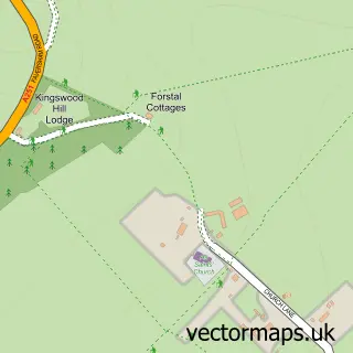
This Molash street map is a detailed vector street map covering a 750m x 750m area. Select a larger area to create and download your own vector street map of Molash.
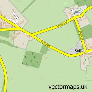
The 750-metre map sample for Molash covers 73 mapped buildings and approximately 6.5 km of road detail, of which 4 named roads are named. The immediate area includes 1 pub and 2 MOT stations within 2 miles. The wider area around Molash features 1 food and drink venue. To create a larger or custom map of Molash, the map builder lets you define your own coverage area and download editable SVG, PDF and PNG files.
Create a larger editable map of Molash
Choose any area you need and generate a high-quality vector map instantly. Perfect for print, planning, design, business and personal use.

This Molash street map in Kent is available as downloadable SVG, PDF and PNG map files, or as a printed map for planning, business, display, education, local information and design work. You can also create a larger custom map area using the map selector.
What this Molash map sample shows
Molash lies within Molash Cp parish, part of Downs North ward in the Ashford District (B) local authority area. The postcode geography for this area includes the CT postcode area, the CT4 postcode district and the CT4 8 postcode sector. Residents fall under the Nhs Kent And Medway Integrated Care Board for NHS services.
Local features near Molash
Within 2 milesAmenities and services in and around Molash.
Administrative and postcode information for Molash
The local authority covering Molash is Ashford District (B), within the county of Kent. The settlement lies within Downs North ward and Molash Cp civil parish. The CT4 postcode district and CT4 8 postcode sector serve the immediate area. NHS provision in the area is delivered through East Kent Hospitals University Nhs Foundation Trust.
Nearby street map samples around Molash

More street maps in Kent
750 metre map area coverage
Boundary, postcode and point of interest information for the 750m x 750m rectangle centred on this sample map.
Boundaries containing map centre
Constituency: Weald of Kent Co Const
County: Kent County
District: Ashford District (B)
Icb: NHS Kent and Medway ICB
Parish: Molash CP
Police Force: kent
Postcode District: CT4
Postcode Sector: CT4 8
Ward: Downs North Ward
Nearby boundaries intersecting sample
No additional intersecting boundaries found.
Postcode coverage
POI category counts
Accountant: 1
Anglican Church: 1
Automotive Repair: 1
Church Cathedral: 1
Freight And Cargo Service: 1
Landscape Architect: 1
Pub: 1
Truck Dealer For Businesses: 1
Sample points of interest
- John Sudworth
- St Peter
- Freeland Garage Services
- St Peter's Church
- JH & D Smith Coaches
- Gw Landscaping
- The George Inn
- K R Waters
Create a larger editable map of Molash
This sample shows only a 750 metre area. To create a larger map of Molash, use our map builder to choose your own coverage area, add titles and download editable SVG, PDF and PNG files.
Create a custom map of Molash